Sat, Mar 10, 2018
Heat Signature Found Within 15 Minutes Of Drone Launch
On March 1 at approximately 10:30 pm, Moore County (NC) Sheriff’s deputies were dispatched to a residence off of Flowers Road in Jackson Springs, NC reference a missing 11 year old female. Sheriff’s Deputies responded to the home and began their search. Moore County Sheriff’s Office Drone Pilot, Lieutenant Tim Davis, arrived at the residence with the Matrice 210 Drone and immediately launched it to search for the child. Within fifteen minutes, a heat signature was observed in the wooded area approximately 100 yards from the residence across the highway.
Lieutenant Davis was able to use his radio to direct Deputies Sergeant Cameron and Deputies Oaks and Griffin to that location. Deputies were able to locate the small sleeping child tucked away under some thick tree limbs and brush.
“This is a perfect example of why we invested in this drone capability” said Sheriff Neil Godfrey. “The Moore County Sheriff’s Office is doing everything we can to ensure that we are using technology to benefit the safety of our citizens as well as our deputies. Without the drone, we would have had to employ additional resources that historically would have included a helicopter. As a parent, I am happy for the child and the family that last night’s flight was a success and as the Sheriff, I am proud of Lieutenant Davis and our deputies.”
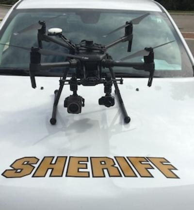
The DJI Matrice 210 Unmanned Aerial Vehicle is a dual-camera UAV for simultaneous thermal and standard color imagery. It has an upward-facing gimbal mount, weather resistant design, dual battery bays, thermal imaging and an extensive zoom. The Moore County Sheriff’s Office UAV with its capabilities makes it ideal for law enforcement search and rescue in locations that are difficult to approach. The Matrice 210 can fly for up to 35 minutes and features an operation range of 4.4 miles. It has two controllers, one for the pilot and one for the observer to control the cameras.
(Image provided with Moore County, NC Sheriff's Department news release)
More News
Its Offerings Are Lighter, Cleaner, and Now Pushing Past 1,000nm on SAF Jet Fuel DeltaHawk’s diesel-powered aircraft lineup has seen incredible upgrades over the last few yea>[...]
The Airplane Experienced A Total Loss Of Engine Power On December 3, 2025, about 1600 central standard time, a Mooney Aircraft Corp. M20K, N57229, was substantially damaged when it>[...]
Make Sure You NEVER Miss A New Story From Aero-News Network Do you ever feel like you never see posts from a certain person or page on Facebook or Instagram? Here’s how you c>[...]
Aero Linx: European Society of Aerospace Medicine (ESAM) As a pan-European, independent forum, it works to promote the safety and health of all persons involved in aviation and spa>[...]
“We are excited to see Wisk achieve this milestone, and I’m so proud of the team that made it possible. The team at Wisk has built advanced technologies across flight c>[...]
 Aero-TV: DeltaHawks Diesel Power Steps Into the Spotlight

