Mon, Jul 26, 2010
Jeppesen Charts Available Soon For Portable GPS
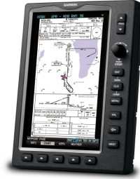
Garmin International's new and enhanced chart capabilities for
the GPSMAP 695/696 have been introduced Monday at AirVenture. This
top-of-the-line aviation portable will soon include georeferenced
Garmin FliteCharts, and cutomers also have the opportunity to
immediately subscribe to and receive Garmin’s georeferenced
ChartView powered by Jeppesen.
“We constantly solicit customer feedback in order to make
our products better, and these enhancements are a direct result of
customers’ requests for georeferenced charts,” said
Gary Kelley, Garmin’s vice president of marketing. “The
696 has a large, 7-inch portrait screen that is ideal for viewing
an entire approach plate. Now, pilots will be able to see their
aircraft’s exact position while monitoring other important
information on the approach
charts.”
Garmin FliteCharts is an electronic version of the National
Aeronautical Navigation Services Charts (AeroNav Services), which
was formerly NACO. FliteCharts lets pilots quickly find and view
all AeroNav Services Departure Procedures (DP), Standard Terminal
Arrival Routes (STARs), approach charts, and airport diagrams. If
the current approach is known, the GPSMAP 695/696 automatically
selects the correct chart based on the flight plan. Pilots will
have access to all approach plates currently published by AeroNav,
which encompasses over 15,000 charts and over 2,900 airports in the
U.S. FliteCharts updates are available from Garmin every 28 days,
and the new georeferenced capability will be included with the
regular updates.
ChartView brings an electronic version of Jeppesen’s
extensive, worldwide library of JeppView charts and airport
diagrams directly to the GPSMAP 695/696. ChartView displays
approach charts, arrival and departure procedures, and airport
diagrams.
Updates are available from Jeppesen every 14 days. The new
georeferenced version of Garmin FliteCharts will be available in
the fourth quarter 2010. FliteChart’s georeferenced support
is included in the standard FliteChart update. ChartView is
available immediately and will require a one-time additional $499
enabling key via fly.garmin.com, as well as the latest free device
software.
More News
Its Offerings Are Lighter, Cleaner, and Now Pushing Past 1,000nm on SAF Jet Fuel DeltaHawk’s diesel-powered aircraft lineup has seen incredible upgrades over the last few yea>[...]
The Airplane Experienced A Total Loss Of Engine Power On December 3, 2025, about 1600 central standard time, a Mooney Aircraft Corp. M20K, N57229, was substantially damaged when it>[...]
Make Sure You NEVER Miss A New Story From Aero-News Network Do you ever feel like you never see posts from a certain person or page on Facebook or Instagram? Here’s how you c>[...]
Aero Linx: European Society of Aerospace Medicine (ESAM) As a pan-European, independent forum, it works to promote the safety and health of all persons involved in aviation and spa>[...]
“We are excited to see Wisk achieve this milestone, and I’m so proud of the team that made it possible. The team at Wisk has built advanced technologies across flight c>[...]
 Aero-TV: DeltaHawks Diesel Power Steps Into the Spotlight

