Thu, Oct 03, 2019

Advertisement
More News
 Classic Aero-TV: Active Winglets -- Tamarack Aerospace Partners with Cessna
From 2014 (YouTube Version): Innovative Aerodynamic Technologies Produce Game-Changing Results At the NBAA 2013 convention, ANN CEO and Editor-In-Chief, Jim Campbell had a chance t>[...]
Aero-News: Quote of the Day (05.03.25)
“This plan opens insurance options to a much wider variety of Canadian aviators across the country who have otherwise had more challenges with securing insurance coverage... >[...]
ANN's Daily Aero-Term (05.03.25): Taxi
Taxi The movement of an airplane under its own power on the surface of an airport (14 CFR section 135.100 [Note]). Also, it describes the surface movement of helicopters equipped w>[...]
ANN's Daily Aero-Linx (05.03.25)
Aero Linx: The Vertical Flight Society (VFS) The Vertical Flight Society, formerly the American Helicopter Society, is the non-profit technical society for the advancement of verti>[...]
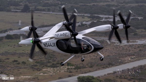
Airborne 05.02.25: Joby Crewed Milestone, Diamond Club, Canadian Pilot Insurance
Also: Sustainable Aircraft Test Put Aside, More Falcon 9 Ops, Wyoming ANG Rescue, Oreo Cookie Into Orbit Joby Aviation has reason to celebrate, recently completing its first full t>[...]
blog comments powered by Disqus