Fri, Dec 10, 2004
GeoVantage Provided High-Rez Digital Aerial Photography of
Ocean Spray Cranberry Bogs
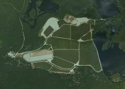
 Ocean Spray’s cranberry
harvesting season drew to a close last month, made easier this year
with the use of GeoVantage’s high-resolution aerial imagery.
GeoVantage imaged cranberry bogs in two of Ocean Spray’s
major growing areas in Massachusetts and Quebec.
Ocean Spray’s cranberry
harvesting season drew to a close last month, made easier this year
with the use of GeoVantage’s high-resolution aerial imagery.
GeoVantage imaged cranberry bogs in two of Ocean Spray’s
major growing areas in Massachusetts and Quebec.
Ocean Spray has been implementing aerial photography since 1986.
They made the switch to digital imagery from conventional
film-based photos in 2002, when they selected GeoVantage as their
primary digital aerial imagery provider.
“We chose GeoVantage because of the quality of their imagery
product, and the competitive price that came along with it,”
explains Lyn DiBiase, Principal GIS Analyst at Ocean Spray,
“Our growing areas are located across the U.S. and Canada,
from New Jersey to British Columbia – GeoVantage’s
technology uniquely positions them to comprehensively deliver
imagery of any location. This makes my job that much easier because
I can work with a single provider for all my imagery and receive
consistent, high quality work.”
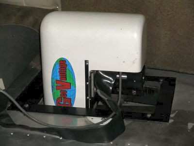
GeoVantage collects full color and near infrared digital imagery
simultaneously by implementing a fully digital workflow and a
multispectral camera system that is integrated with a global
positioning system (GPS) and inertial measurement unit (IMU). The
process enables imagery to be precisely georegistered and
orthorectified. GeoVantage’s systems are compact and
portable, which means they can be deployed rapidly anywhere in the
world and mounted on local aircraft for image capture.
DiBiase uses the resulting imagery in several ways. Imagery is
used to help on the business end – to map the land Ocean
Spray has under contract with growers who own the cooperative. By
determining the number of acres in production, Ocean Spray can
estimate the number of barrels growers will deliver in a harvest
and make business projections.
DiBiase also provides the imagery to individual growers to help
in their land management. The imagery can reveal drainage problems,
weed and insect infestation and when it may be time to renovate
certain areas. “Helping growers to better interpret and
utilize imagery data is one of my priorities. More and more, we can
apply new technologies to help improve and fine-tune our
production. The switch to digital imagery from film-based alone has
made my work more time-effective and accurate, reducing the chance
for operator error.”
More News
After Draining Both Wing Fuel Tanks, A Significant Amount Of Water Was Observed In The Right Wing Fuel Tank Analysis: The pilot, who was also the owner of the experimental amateur->[...]
“Airbus apologises for any challenges and delays caused to passengers and airlines by this event. The Company thanks its customers, the authorities, its employees and all rel>[...]
High Speed Taxiway A long radius taxiway designed and provided with lighting or marking to define the path of aircraft, traveling at high speed (up to 60 knots), from the runway ce>[...]
Aero Linx: Taylorcraft Foundation, Inc. The Taylorcraft Foundation is exclusively organized for charitable, educational & scientific activities and will preserve the history an>[...]
Also: USAF Reaper Accident, Baikonur Damage, Horizon eVTOL IFR/FIKI, New Glenn Update Honda has outlined its clearest timeline yet for its entry into the world of electric vertical>[...]
 NTSB Final Report: Patriot Aircraft LLC CX1900A

