Measure Releases Software Solution For Enterprise Drone Programs | Aero-News Network
Aero-News Network
RSS icon RSS feed
podcast icon MP3 podcast
Subscribe Aero-News e-mail Newsletter Subscribe

Airborne Unlimited -- Most Recent Daily Episodes

Episode Date

Airborne-Monday

Airborne-Tuesday

Airborne-Wednesday Airborne-Thursday

Airborne-Friday

Airborne On YouTube

Airborne-Unlimited-07.07.25

Airborne-NextGen-07.08.25

AirborneUnlimited-07.09.25

Airborne-FlightTraining-07.10.25

AirborneUnlimited-07.11.25

Fri, Mar 30, 2018

Measure Releases Software Solution For Enterprise Drone Programs

'Ground Control' Is A Cloud-Based Program Management Portal

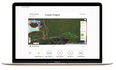
Enterprise drone service company Measure has released "Ground Control", a software platform that integrates a user-friendly flight application with a cloud-based program management portal. Ground Control is designed to provide the streamlined operations and program oversight that enterprises need to scale their drone programs and realize the transformative benefits of aerial intelligence.

“Despite the hype surrounding drones, enterprises are struggling to reach operational scale,” said Jesse Stepler, Measure’s Chief Strategy Officer and Head of Product. “Ground Control is revolutionary in its ability to enable users to fly easier and safer than ever before, automate data capture and workflows, and manage thousands of flights, all in real time.”

Measure has completed thousands of commercial flights across a wide variety of applications while maintaining an industry-leading safety record. This real-world experience informed the creation of Ground Control, designed to address the challenges that accumulate as drone programs grow and make it easier to set and track safety-related best practices and company policies.

Ground Control combines flight control, flight logging, program management, equipment health tracking, and more into a single solution.

Features include: A streamlined flight app for pilots Fleet-wide auditing and reporting Safety controls and notifications Enhanced data security Real-time airspace authorization Automatic uploads of flight data and screen captures

The platform is already in use with AES, a global power company. “We see great value in Ground Control’s worldwide flight management, starting with in-flight safety risk notifications and mapping of restrictive areas,” notes Evaristo Leonardi, VP Global Operations Support at AES. “Our pilots enjoy its ease of use and our operators appreciate the automatic uploads of imagery which they use to extract valuable insights to improve our operations and safety.”

The app is now available for iPad in the App Store. Measure Ground Control software is $29.99 per user per month.

(Source: measure news release)

FMI: www.measure.com/ground-control

Advertisement

More News

Aero-News: Quote of the Day (07.11.25)

“Honored to accept this mission. Time to take over space. Let’s launch.” Source: SecTrans Sean Duffy commenting after President Donald Trump appointed U.S. Secret>[...]

ANN's Daily Aero-Term (07.11.25): Permanent Echo

Permanent Echo Radar signals reflected from fixed objects on the earth's surface; e.g., buildings, towers, terrain. Permanent echoes are distinguished from “ground clutter&rd>[...]

ANN's Daily Aero-Linx (07.11.25)

Aero Linx: European Hang Gliding and Paragliding Union (EHPU) The general aim of the EHPU is to promote and protect hang gliding and paragliding in Europe. In order to achieve this>[...]

NTSB Final Report: Schweizer SGS 2-33A

Glider Encountered A Loss Of Lift And There Was Not Sufficient Altitude To Reach The Airport Analysis: The flight instructor reported that while turning final, the glider encounter>[...]

NTSB Prelim: Aeronca 7AC

Airplane Climbed To 100 Ft Above Ground Level, At Which Time The Airplane Experienced A Total Loss Of Engine Power On May 24, 2025, at 1300 eastern daylight time, an Aeronca 7AC, N>[...]

blog comments powered by Disqus


Advertisement

Advertisement

Podcasts

Advertisement

© 2007 - 2025 Web Development & Design by Pauli Systems, LC