Pilot Apparently Proceeded VFR Into IFR Conditions
 The NTSB has released its
preliminary report into an accident in which a Piper PA-32 impacted
a mountainside while on approach to Honolulu International Airport.
The accident killed the 61-year-old pilot and his 20 year old
son.
The NTSB has released its
preliminary report into an accident in which a Piper PA-32 impacted
a mountainside while on approach to Honolulu International Airport.
The accident killed the 61-year-old pilot and his 20 year old
son.
NTSB Identification: WPR10FA107
14 CFR Part 91: General Aviation
Accident occurred Sunday, January 10, 2010 in Honolulu, HI
Aircraft: PIPER PA-32-300, registration: N8934N
Injuries: 2 Fatal.
This is preliminary information, subject to change,
and may contain errors. Any errors in this report will be corrected
when the final report has been completed.
On January 10, 2010, about 1345 Hawaiian standard time, a Piper
PA-32-300, N8934N, impacted the southeast side of a ridge while
approaching the Honolulu International Airport, Honolulu, Hawaii.
The pilot, who was additionally the owner, was operating the
airplane under the provisions of 14 Code of Federal Regulations
Part 91. The non-instrument rated private pilot and one passenger
sustained fatal injuries; the airplane was destroyed. The personal
cross-country flight originated from Lanai Airport on the island of
Lanai, Hawaii, about 1315, with a planned destination of Honolulu
on the island of Oahu. Instrument meteorological conditions
prevailed in the area surrounding the accident site, and the pilot
was receiving visual flight rules (VFR) flight following; he had
not filed a flight plan.
Family members reported that the purpose of the accident flight
was for the pilot, a Veterinarian, to return from working on Lanai.
As on almost every Sunday, the pilot commuted from Honolulu to
Lanai to see patients, with his work hours ending around 1200. The
pilot had an extensive history flying on the island and had
performed thousands of flights between Lanai and Honolulu. Although
the passenger did not hold a pilot certificate, he would often fly
with the pilot, his father.
A group of hikers were near the accident site and witnessed the
airplane just prior to impact. One hiker reported that in "very
cloudy, poor visibility," conditions he heard an airplane crash
into a ridge about 50 yards from his location. He recalled that he
could "hear the engine all the way," and that the airplane did not
seem to turn or pull up. He further stated that visibility was so
bad that he was not able to see the airplane. Another hiker
reported that the ridge was obscured by clouds and he heard the
engine "running the whole time," prior to the airplane crashing.
Another hiker stated that she heard an airplane flying low and
briefly observed it pass by before it disappeared in the cloud
layer.
A different witness recalled that he was almost at the peak of
the ridge when he noticed an airplane flying low in the mountains;
he observed it crash into a ridge. Shortly thereafter, he observed
the clouds move in and he could no longer see the wreckage. He
stated that when the airplane impacted, there were "heavy clouds
and the mountain was hard to see." Another hiker stated that she
heard the airplane as it came closer and the noise became louder.
It was flying toward the ocean and then suddenly turned into the
mountain. An additional hiker observed the airplane flying at
eye-level to him. It veered to the right and he heard it crash into
the ridge.
The direct route of flight from Lanai to Honolulu is about 63
nautical miles (nm) on a course of 300 degrees true. The pilot was
on the Kona Arrival to Honolulu Airport at the time of the
accident, which is an arrival procedure for VFR aircraft. As
published, the arrival procedure is to proceed to KoKo Head, a very
high frequency omni-directional radio range tactical air navigation
aid (VORTAC), and then continue to the Waialae Golf Course.
Thereafter, the pilot is to follow the H-1 Freeway to enter the
left base of the traffic pattern for runway 22L.
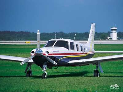
File Photo
During the investigation, the recorded
voice channels from the Honolulu Air Traffic Control Facility and
recorded radar data were obtained and reviewed by a National
Transportation Safety Board investigator. While the airplane was en
route to Honolulu, the pilot was in communication with Honolulu air
traffic controllers and receiving flight following services.
At 1332, the approach controller directed the pilot to proceed
to Koko Head, to which the pilot replied that he would like to
receive a vector. The controller provided a vector of 290 degrees
and at 1335, the pilot reported "no joy on Oahu." The controller
directed the pilot to resume his own navigation to runway 22L via
the Kona Arrival. At 1339, the pilot reported that he was abeam
Koko Head and the controller replied that after passing KoKo Head
the pilot could descend at his discretion. Several minutes later,
at 1342, the pilot reported that he was "in the rain at golf course
[and] proceeding to punchbowl."
At 1344, the pilot reported that he was at punchbowl at an
altitude of 1,900 msl and proceeding inbound for landing on runway
22L. The controller responded by stating that the airplane was in
actuality "heading toward the mountains, toward the other side of
the island," and that he was going into Ana Hina. The pilot
immediately requested for the controller to vector him "to
intercept landing," which was the last transition he made. The
controller instructed the pilot to make either a left or right turn
southbound to a suggested heading of 180 degrees.
Recorded radar data covering the area of the accident was
examined for the time frame, and a discreet secondary beacon code
target was observed that matched the anticipated flight track of
the airplane en route from Lanai to Honolulu.
A review of the data disclosed that at 1339, when the pilot
reported that he was abeam Koko Head, the target at the
corresponding time is located about 5 miles from the VORTAC to the
east-southeast. Several minutes later, when the pilot reported he
was at the golf course, the target was about 0.5 miles off the
shoreline and about 2.5 miles east of the golf course. As the radar
track reached land, the altitude stayed at 1,700 feet until
reaching the rising terrain, where the last recorded altitudes were
1,800 feet. The majority of these radar returns were all spaced
uniformly and followed a track of about 330 degrees true. The last
radar return was recorded at 1344, and located about 0.5 miles
southeast from the accident site.
The wreckage was located at an elevation of about 1,950 feet
msl. The accident site was approximately 10 nautical miles east of
the airport and about 4 miles east of the H-1 Freeway. The main
wreckage, consisting of the fuselage, tail section, and wings, had
come to rest about 30 feet below the peak of an east-west oriented
ridge. The wreckage was in rugged terrain, on a slope of about 80
degrees that was comprised of rock outcroppings and thick
vegetation.
A routine aviation weather report (METAR) for Honolulu was
issued at 1353. It stated: skies 1,800 feet scattered, 2,400 feet
broken; visibility 7 statute miles (sm) with light rain;
temperature 23 degrees Celsius; dew point 21 degrees Celsius;
altimeter 29.91 inches of mercury; visibility to the west 1.5
sm.
The wreckage was retained for further investigation.
 Classic Aero-TV: Extra Aircraft Announces the Extra 330SX

