High Resolution Aerial Imagery Added To True Flight Cheetah Portable MFD | Aero-News Network
Aero-News Network
RSS icon RSS feed
podcast icon MP3 podcast
Subscribe Aero-News e-mail Newsletter Subscribe

Airborne Unlimited -- Most Recent Daily Episodes

Episode Date

Airborne-Monday

Airborne-Tuesday

Airborne-Wednesday Airborne-Thursday

Airborne-Friday

Airborne On YouTube

Airborne-Unlimited-05.05.25

Airborne-NextGen-05.06.25

AirborneUnlimited-05.07.25

Airborne-Unlimited-05.01.25

AirborneUnlimited-05.02.25

Sat, Jul 24, 2010

High Resolution Aerial Imagery Added To True Flight Cheetah Portable MFD

Resolution At 21 Feet For The Lower 48 United States

High-resolution aerial imagery mapping for the entire contiguous lower 48 states has been incorporated by True Flight for its line of portable Flight Cheetah multi-function GPS displays. In an announcement Thursday, True Flight said the addition of aerial imagery demonstrates True Flight's ability to bring to market technologies that will have a substantial impact on safety, yet remain affordable to every cockpit.


Aerial Image Screen Shot

The Flight Cheetah MFD will allow pilots to overlay aerial imagery providing a view of the terrain conditions below.  Should an emergency happen in IFR conditions or at night and an airport is not within reach, this unique ability to separate areas of buildings and trees from fields could be a life saving feature.  The aerial maps are at a resolution of 21 feet for the entire United States. The high-resolution aerial imagery will replace the satellite imagery previously provided to True Flight customers.

This feature will allow pilots to view the terrain below in direct relation to their current aircraft position. Pilots will also have the option to overlay any type of navigational information and/or weather on top of the aerial maps.


True Flight Cheetah MFD

"I can tell you firsthand having dealt with an engine problem at night many years ago, all those jokes about waiting till you get close to the ground and turning on your landing light and if you don't like what you see turning it off loses something in translation when it is actually happening to you. The addition of high resolution aerial terrain imagery will substantially improve situational awareness and safety to new highs in aviation", said Robert Kalberer president of True Flight.

Aerial imagery has already been released for Florida, Georgia, Mississippi, Alabama, and Louisiana. The aerial imagery will be released for the rest of the US over the next two months several states at a time.

FMI: www.aviationsafety.com

Advertisement

More News

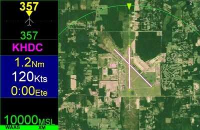
ANN's Daily Aero-Term (05.07.25): Terminal Radar Service Area

Terminal Radar Service Area Airspace surrounding designated airports wherein ATC provides radar vectoring, sequencing, and separation on a full-time basis for all IFR and participa>[...]

ANN's Daily Aero-Linx (05.07.25)

Aero Linx: Utah Back Country Pilots Association (UBCP) Through the sharing experiences, the UBCP has built upon a foundation of safe operating practices in some of the most challen>[...]

Classic Aero-TV: Anousheh Ansari -- The Woman Behind The Prize

From 2010 (YouTube Edition): Imagine... Be The Change... Inspire FROM 2010: One of the more unusual phone calls I have ever received occurred a few years ago... from Anousheh Ansar>[...]

NTSB Prelim: Bell 206B

(Pilot) Felt A Shudder And Heard The Engine Sounding Differently, Followed By The Engine Chip Detector Light On April 14, 2025, about 1800 Pacific daylight time, a Bell 206B, N1667>[...]

Airborne-NextGen 05.06.25: AF Uncrewed Fighters, Drones v Planes, Joby Crew Test

Also: AMA Names Tyler Dobbs, More Falcon 9 Ops, Firefly Launch Unsuccessful, Autonomous F-16s The Air Force has begun ground testing a future uncrewed jet design in a milestone tow>[...]

blog comments powered by Disqus


Advertisement

Advertisement

Podcasts

Advertisement

© 2007 - 2025 Web Development & Design by Pauli Systems, LC