DJI Geofences Much Of Iraq And Syria | Aero-News Network
Aero-News Network
RSS icon RSS feed
podcast icon MP3 podcast
Subscribe Aero-News e-mail Newsletter Subscribe

Airborne Unlimited -- Most Recent Daily Episodes

Episode Date

Airborne-Monday

Airborne-Tuesday

Airborne-Wednesday Airborne-Thursday

Airborne-Friday

Airborne On YouTube

Airborne-Unlimited-07.07.25

Airborne-NextGen-07.08.25

AirborneUnlimited-07.09.25

Airborne-FlightTraining-07.10.25

AirborneUnlimited-07.11.25

Mon, May 01, 2017

DJI Geofences Much Of Iraq And Syria

Goal Is To Prevent ISIS From Using Its Drones

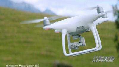
Following reports of ISIS weaponizing small UAVs, DJI has reportedly taken steps to keep the radical Islamic group from using its aircraft.

Vice News reports that DJI has geofenced much of Syria and Iraq. The internal software in the aircraft now recognizes much of those two countries as "no fly zones" much like airspace around an airport or military installation.

Last fall, DJI has issued a statement saying it was prepared to "provide whatever technical assistance we can" to help prevent the use of its aircraft as instruments of war. 

DJI Spokeswoman Dr. Barbara Stelzner said in an email to Vice News that the company's geofencing system is "designed to advise pilots of airspace restrictions, and was never intended to enforce laws or thwart people who want to misuse our products.” She did not way whether the company was specifically asked to geofence much of Iraq and Syria.

DJI has a page on its website where operators can search for geofenced areas worldwide, though Iraq and Syria are not yet on the list.

“Certain areas vital for aviation safety or national security are marked as restricted in our geofencing system, and we are constantly adjusting those areas to account for temporary conditions that create special restrictions, such as wildfires and major public events,” Stelzner said in the email.

(Image from file)

FMI: Original Report 

Advertisement

More News

Classic Aero-TV: Up Close And Personal - The Aeroshell Aerobatic Team at Oshkosh

From 2014 (YouTube Version): One Of The Airshow World's Pre-Eminent Formation Teams Chats About The State Of The Industry At EAA AirVenture 2014, ANN News Editor Tom Patton gets th>[...]

ANN's Daily Aero-Term (07.13.25): Tactical Air Navigation (TACAN)

Tactical Air Navigation (TACAN) An ultra-high frequency electronic rho-theta air navigation aid which provides suitably equipped aircraft a continuous indication of bearing and dis>[...]

ANN's Daily Aero-Linx (07.13.25)

Aero Linx: Doobert Hi, we're Chris & Rachael Roy, founders and owners of Doobert. Chris is a technology guy in his “day” job and used his experience to create Doobe>[...]

NTSB Prelim: Pitts S2

The Airplane Was Spinning In A Nose-Down Attitude Before It Impacted Terrain On June 20, 2025, at 0900 eastern daylight time, a Pitts Aerobatics S-2B, N79AV, was destroyed when it >[...]

Airborne 07.09.25: B-17 Sentimental Journey, Airport Scandal, NORAD Intercepts

Also: United Elite Sues, Newark ATC Transitions, Discovery Moves?, Textron @ KOSH The Commemorative Air Force Airbase Arizona is taking its “Flying Legends of Victory Tour&rd>[...]

blog comments powered by Disqus


Advertisement

Advertisement

Podcasts

Advertisement

© 2007 - 2025 Web Development & Design by Pauli Systems, LC