DJI Geofences Much Of Iraq And Syria | Aero-News Network
Aero-News Network
RSS icon RSS feed
podcast icon MP3 podcast
Subscribe Aero-News e-mail Newsletter Subscribe

Airborne Unlimited -- Most Recent Daily Episodes

Episode Date

Airborne-Monday

Airborne-Tuesday

Airborne-Wednesday Airborne-Thursday

Airborne-Friday

Airborne On YouTube

Airborne-Unlimited-07.07.25

Airborne-NextGen-07.08.25

AirborneUnlimited-07.09.25

Airborne-FlightTraining-07.10.25

AirborneUnlimited-07.11.25

Mon, May 01, 2017

DJI Geofences Much Of Iraq And Syria

Goal Is To Prevent ISIS From Using Its Drones

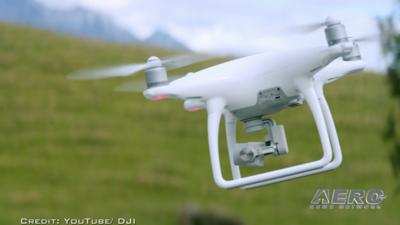
Following reports of ISIS weaponizing small UAVs, DJI has reportedly taken steps to keep the radical Islamic group from using its aircraft.

Vice News reports that DJI has geofenced much of Syria and Iraq. The internal software in the aircraft now recognizes much of those two countries as "no fly zones" much like airspace around an airport or military installation.

Last fall, DJI has issued a statement saying it was prepared to "provide whatever technical assistance we can" to help prevent the use of its aircraft as instruments of war. 

DJI Spokeswoman Dr. Barbara Stelzner said in an email to Vice News that the company's geofencing system is "designed to advise pilots of airspace restrictions, and was never intended to enforce laws or thwart people who want to misuse our products.” She did not way whether the company was specifically asked to geofence much of Iraq and Syria.

DJI has a page on its website where operators can search for geofenced areas worldwide, though Iraq and Syria are not yet on the list.

“Certain areas vital for aviation safety or national security are marked as restricted in our geofencing system, and we are constantly adjusting those areas to account for temporary conditions that create special restrictions, such as wildfires and major public events,” Stelzner said in the email.

(Image from file)

FMI: Original Report 

Advertisement

More News

ANN's Daily Aero-Term (07.12.25): Secondary Radar/Radar Beacon (ATCRBS)

Secondary Radar/Radar Beacon (ATCRBS) A radar system in which the object to be detected is fitted with cooperative equipment in the form of a radio receiver/transmitter (transponde>[...]

ANN's Daily Aero-Linx (07.12.25)

Aero Linx: Australian Society of Air Safety Investigators (ASASI) The Australian Society of Air Safety Investigators (ASASI) was formed in 1978 after an inaugural meeting held in M>[...]

ANN FAQ: Turn On Post Notifications

Make Sure You NEVER Miss A New Story From Aero-News Network Do you ever feel like you never see posts from a certain person or page on Facebook or Instagram? Here’s how you c>[...]

Classic Aero-TV: Of the Aeropup and its Pedigree

From 2023 (YouTube Edition): Barking up the Right Tree Australian-born, the Aeropup is a remarkably robust, fully-customizable, go-anywhere, two-seat, STOL/LSA aircraft. The machin>[...]

Airborne 07.07.25: Sully v Bedford, RAF Vandalism, Discovery Moving?

Also: New Amelia Search, B737 Flap Falls Off, SUN ‘n FUN Unveiling, F-16 Record Captain Sully Sullenberger, the pilot who saved 155 people by safely landing an A320 in the Hu>[...]

blog comments powered by Disqus


Advertisement

Advertisement

Podcasts

Advertisement

© 2007 - 2025 Web Development & Design by Pauli Systems, LC