Technology Developed For Use In Space Has Terrestrial
Applications
On a bluff overlooking the Atlantic, Grady Koch spent a month
watching ocean winds. He beamed a laser over the sea, day after
day, measuring conditions offshore using an instrument called
Doppler Aerosol Wind (DAWN) lidar, which is a type of laser.
Grady Koch With DAWN Instrument
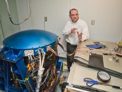
What Koch learns from the experiment will be used by scientists
to advance weather forecasting technology – and also by a
consortium hoping to develop a wind farm in the very spot where the
wind data is being taken. "It's been going well," said Koch, a
scientist at NASA's Langley Research Center here. "We're showing
that we can measure wind at different heights. One issue we've been
working is, how far can we see? We've been able to see pretty well
out to 12 kilometers (7.5 miles)."
The Virginia Coastal Energy Research Consortium, a partnership
of universities, industry, and state and local governments,
proposes the wind farm. The Virginia legislature formed the
consortium in 2007 to develop coastal energy technologies. A wind
farm would provide Virginia with about 10 percent of its power
demand, said George Hagerman, a scientist from consortium partner
Virginia Tech University. "We're at a point now where offshore wind
is not just an academic exercise," he said. "I don't think it's a
question of 'if.' It's a question of when."
Hagerman also said the consortium is working with private and
government agencies to ensure the potential wind farm is placed in
an area where it does not interfere with shipping routes or
military exercises, which are common in the waters off Virginia
Beach. The location under study is about 15 miles off the Atlantic
coast of Virginia Beach, Va. and covers about 240 square miles.
Companies wishing to place wind-powered energy generators in the
area would have to sign leases with the federal government, which
controls the waters, Hagerman said.
The hope is to provide new data for meteorologists so they can
make better forecasts about hurricane intensity, track, and
landfall. Eventually, scientists hope, a DAWN-like instrument will
be launched into space to provide continuous global coverage. A
huge requirement for persuading industry to invest is providing
them with reliable data about wind speed and direction. That's
where NASA Langley comes in. The DAWN laser, a product of three
decades of development for use in weather forecasting, is extremely
powerful, and capable of compiling three-dimensional wind profiles.
"It's much stronger than anything you can buy on the commercial
market," Koch said.
Last year DAWN was part of a research campaign called the
Genesis and Rapid Intensification Process (GRIP) mission. The
campaign was conducted to better understand how tropical storms
form and develop into hurricanes. DAWN's laser function measures
wind speed and direction by tracking dust and other particles in
the wind. The particles, in a sense, illuminate the wind. For the
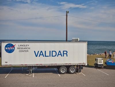
current project, DAWN was fitted to a large trailer and towed from
Langley to the experiment site, a stone's throw from Joint
Expeditionary Base Little Creek-Fort Story, an Army/Navy
installation at Cape Henry, where the Atlantic meets the Chesapeake
Bay. For NASA, the experiment will add much-needed marine wind data
to an existing 30-year dataset about wind. That information will be
used to improve the capabilities of instruments like
DAWN.
Said Koch of the wind-profiling project, "We're proving a
concept." (Images courtesy NASA)
 Sierra Space Repositions Dream Chaser for First Mission

