Plans Underway for Ingenuity’s Sixth Flight | Aero-News Network
Aero-News Network
RSS icon RSS feed
podcast icon MP3 podcast
Subscribe Aero-News e-mail Newsletter Subscribe

Airborne Unlimited -- Most Recent Daily Episodes

Episode Date

Airborne-Monday

Airborne-Tuesday

Airborne-Wednesday Airborne-Thursday

Airborne-Friday

Airborne On YouTube

Airborne-Unlimited-09.23.24

Airborne-NextGen-10.01.24

Airborne-Unlimited-10.02.24

Airborne-AffordableFlyers-10.03.24

Airborne-Unlimited-09.27.24

Fri, May 21, 2021

Plans Underway for Ingenuity’s Sixth Flight

Ingenuity Ready To Start Science Operations

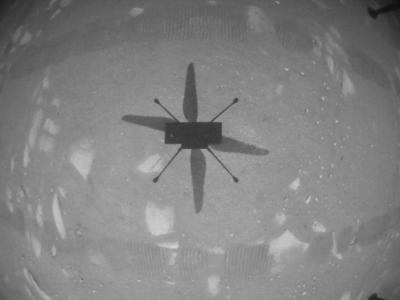
Plans are underway for NASA’s Ingenuity Mars Helicopter to make its sixth flight on the Red Planet in the next week.

The flight is the first to be executed during the helicopter’s operations demonstration phase and includes scouting multiple surface features from the air and landing at a different airfield. In this new phase, data and images from the flight will be returned to Earth in the days following the flight. The Perseverance rover will not record images of the helicopter in flight, as it is preparing for the start of the mission’s science operations.

Ingenuity’s flight plan begins with the helicopter ascending to 33 feet, then heading southwest for about 492 feet. When it achieves that distance, the rotorcraft will begin acquiring color imagery of an area of interest as it translates to the south about 50-66 feet. Stereo imagery of the sand ripples and outcrops of bright rocks at the site will help demonstrate the value of an aerial perspective for future missions. After completing its image collection, Ingenuity will fly about 164 feet northeast where it will touch down at its new base of operations (known as "Field C").

Ingenuity is planning to continue to expand its performance envelope during Flight Six. The top groundspeed Ingenuity is expected to achieve on this flight is 9 mph and the time aloft will be around 140 seconds. It is also the first time the helicopter will land at an airfield which it did not survey from the air during a previous mission. Instead, the Ingenuity team is relying on imagery collected by the HiRISE camera aboard NASA’s Mars Reconnaissance Orbiter that suggests this new base of operations is relatively flat and has few surface obstructions.

FMI: https://mars.nasa.gov/


Advertisement

More News

ANN's Daily Aero-Term (10.02.24): Execute Missed Approach

Execute Missed Approach Instructions issued to a pilot making an instrument approach which means continue inbound to the missed approach point and execute the missed approach proce>[...]

Aero-News: Quote of the Day (10.02.24)

“NORAD aircraft flew a safe and disciplined intercept of Russian Military Aircraft in the Alaska ADIZ... The conduct of one Russian Su-35 was unsafe, unprofessional, and enda>[...]

Aero-FAQ: Dave Juwel's Aviation Marketing Stories -- ITBOA BNITBOB

Dave Juwel's Aviation Marketing Stories ITBOA BNITBOB ... what does that mean? It's not gibberish, it's a lengthy acronym for "In The Business Of Aviation ... But Not In The Busine>[...]

NTSB Prelim: Air Tractor Inc AT-602

Airplane Was Flying West Along The North Edge Of The Field When The Outboard 3 Ft Of The Right Wing Impacted A Power Transformer On September 5, 2024, about 1014 mountain daylight >[...]

NTSB Prelim: Boeing A75L3

The Wreckage Was Located At The Base Of An Approximate 100 Ft Tall Tree On September 6, 2024, about 1259 Pacific daylight time, a Boeing A75L3, N53466, was substantially damaged wh>[...]

blog comments powered by Disqus


Advertisement

Advertisement

Podcasts

Advertisement

© 2007 - 2024 Web Development & Design by Pauli Systems, LC