North Dakota Uses BVLOS Test Network for Utility Recovery | Aero-News Network
Aero-News Network
RSS icon RSS feed
podcast icon MP3 podcast
Subscribe Aero-News e-mail Newsletter Subscribe

Airborne Unlimited -- Most Recent Daily Episodes

Episode Date

Airborne-Monday

Airborne-Tuesday

Airborne-Wednesday Airborne-Thursday

Airborne-Friday

Airborne On YouTube

Airborne-Unlimited-06.23.25

Airborne-NextGen-06.24.25

AirborneUnlimited-06.25.25

Airborne-AffordableFlyers-06.26.25

AirborneUnlimited-06.27.25

Sat, Apr 30, 2022

North Dakota Uses BVLOS Test Network for Utility Recovery

Harsh Weather Obtains Remote Inspection Services Using Vantis Network

The state's Northern Plains UAS Test Site (NPUASTS) has once again proven to be a fine investment, bringing a plethora of uncrewed aircraft operators into the state, perfectly poised to aid in case of emergency. 

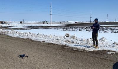
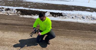
This week, a round of severe weather brought blizzards, heavy snow, and icing across western North Dakota, hampering emergency services and embattling public works with harsh conditions and overwork. Governor Doug Burgum announced a joint release with NPUASTS that they would enlist UAS operators to survey rural areas, locating and assessing damage to utility infrastructure in order to triage recovery efforts. 

The remotely piloted drones, flown by ISight Drone Services and the NPUASTS, are able to operate BVLOS flights as part of the state's creation and implementation of its unique UAS network, Vantis. The flights were cleared with the FAA before rolling out, allowing them to assist the North Dakota Association of Rural Electric Cooperatives. Their work in assessing and inspecting utilities is estimated to have brought expected downtime to days as opposed to the weeks that would be taken for on-site human inspection. 

“This is one of the primary applications we envisioned in creating this UAS network,” said Trevor Woods, NPUASTS executive director. “We hope this nimble response can help the state’s residents in getting life-saving power restored, and benefit areas and businesses affected by the natural disaster. For such a massive undertaking in fixing lines and infrastructure, we know that locating damage in difficult-to-travel-to areas saves time and assets that can’t afford to be wasted.” 

FMI: www.vantisuas.com

Advertisement

More News

ANN's Daily Aero-Linx (06.29.25)

Aero Linx: Transport Canada We are a federal institution, leading the Transport Canada portfolio and working with our partners. Transport Canada is responsible for transportation p>[...]

ANN's Daily Aero-Term (06.29.25): Gross Navigation Error (GNE)

Gross Navigation Error (GNE) A lateral deviation from a cleared track, normally in excess of 25 Nautical Miles (NM). More stringent standards (for example, 10NM in some parts of th>[...]

Classic Aero-TV: Anticipating Futurespace - Blue Origin Visits Airventure 2017

From AirVenture 2017 (YouTube Edition): Flight-Proven Booster On Display At AirVenture… EAA AirVenture Oshkosh is known primarily as a celebration of experimental and amateu>[...]

NTSB Final Report: Cirrus SR22

Aircraft Parachute System (CAPS) Was Deployed About 293 Ft Above Ground Level, Which Was Too Low To Allow For Full Deployment Of The Parachute System Analysis: The day before the a>[...]

Airborne Affordable Flyers 06.26.25: PA18 Upgrades, ‘Delta Force’, Rhinebeck

Also: 48th Annual Air Race Classic, Hot Air Balloon Fire, FAA v Banning 100LL, Complete Remote Pilot The news Piper PA-18 Super Cub owners have been waiting for has finally arrived>[...]

blog comments powered by Disqus


Advertisement

Advertisement

Podcasts

Advertisement

© 2007 - 2025 Web Development & Design by Pauli Systems, LC