FDS Avionics Launches Two New Moving Maps | Aero-News Network
Aero-News Network
RSS icon RSS feed
podcast icon MP3 podcast
Subscribe Aero-News e-mail Newsletter Subscribe

Airborne Unlimited -- Most Recent Daily Episodes

Episode Date

Airborne-Monday

Airborne-Tuesday

Airborne-Wednesday Airborne-Thursday

Airborne-Friday

Airborne On YouTube

Airborne-Unlimited-06.23.25

Airborne-NextGen-06.24.25

AirborneUnlimited-06.25.25

Airborne-AffordableFlyers-06.26.25

AirborneUnlimited-06.27.25

Mon, Mar 13, 2017

FDS Avionics Launches Two New Moving Maps

Rolls Out Interactive 2D And 3D Maps For BizAV Passengers

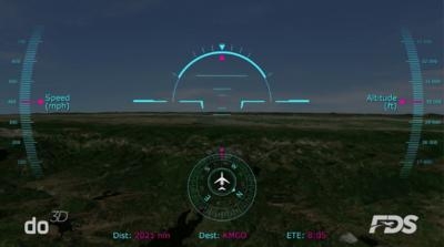
FDS Avionics has rolled out two new moving maps for business and private aviation. Both maps, do 3D Moving Map and do 2D Moving Map, are standalone hardware solutions that use technology developed for the do CAPSULE.

do 3D Moving Map provides an intensely detailed three-dimensional moving map experience for private and business aircraft. The do 3D map can be configured to show different views and levels of detail, up to 15 square meters, per pixel, on a bulkhead display. With the wireless upgrade, passengers can explore surrounding areas interactively on mobile devices, changing the view angle with a finger swipe.

do 2D Moving Map delivers high resolution satellite imagery up to 20 square meters, per pixel. Passengers can view the map on a bulkhead display or, with the wireless upgrade, interactively explore surroundings using their mobile device.

With the wireless upgrade option, both moving maps can be controlled wirelessly using the do CAPSULE. The maps also provide flight data such as speed, altitude and ETA via an aircraft’s onboard avionics system.

"We listened when our customers and partners asked for a better map," says Dave Dodson, Marketing Director, "and we've delivered two exceptional choices – 2D and 3D."

Both the do 3D Moving Map and the do 2D Moving Map have the following features:

  • Pan and zoom to explore the map
  • Heads up flight data
  • Relative city locator
  • Customizable POI library (user waypoints)

(Images provided with FDS Avionics news release)

FMI: www.FDSAvionics.com

Advertisement

More News

ANN's Daily Aero-Linx (06.29.25)

Aero Linx: Transport Canada We are a federal institution, leading the Transport Canada portfolio and working with our partners. Transport Canada is responsible for transportation p>[...]

ANN's Daily Aero-Term (06.29.25): Gross Navigation Error (GNE)

Gross Navigation Error (GNE) A lateral deviation from a cleared track, normally in excess of 25 Nautical Miles (NM). More stringent standards (for example, 10NM in some parts of th>[...]

Classic Aero-TV: Anticipating Futurespace - Blue Origin Visits Airventure 2017

From AirVenture 2017 (YouTube Edition): Flight-Proven Booster On Display At AirVenture… EAA AirVenture Oshkosh is known primarily as a celebration of experimental and amateu>[...]

NTSB Final Report: Cirrus SR22

Aircraft Parachute System (CAPS) Was Deployed About 293 Ft Above Ground Level, Which Was Too Low To Allow For Full Deployment Of The Parachute System Analysis: The day before the a>[...]

Airborne Affordable Flyers 06.26.25: PA18 Upgrades, ‘Delta Force’, Rhinebeck

Also: 48th Annual Air Race Classic, Hot Air Balloon Fire, FAA v Banning 100LL, Complete Remote Pilot The news Piper PA-18 Super Cub owners have been waiting for has finally arrived>[...]

blog comments powered by Disqus


Advertisement

Advertisement

Podcasts

Advertisement

© 2007 - 2025 Web Development & Design by Pauli Systems, LC