Tue, Jun 25, 2019
Agreement Combines Areas Of Expertise Of The Two Companies
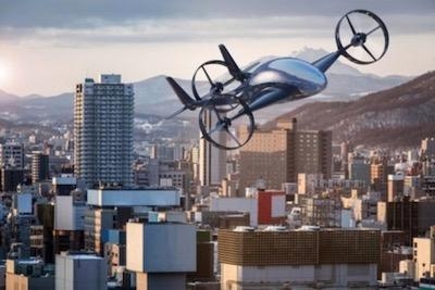
Raytheon Company has signed a strategic agreement with AirMap to collaborate on future projects to safely integrate unmanned aerial systems, commonly referred to as drones, into the national airspace system and unlock the positive economic and social benefits of expanded commercial drone operations.
Unmanned air traffic control advances will unlock safe, efficient, and scalable drone operations with a myriad of economic and social benefits.
"AirMap is ushering in a new era in drone aviation," said Matt Gilligan, vice president of Raytheon's Intelligence, Information and Services business. "Drones must safely operate in an already complex ecosystem, which is where our experience matters."
The agreement combines the two companies' expertise:
- Raytheon's Standard Terminal Automation Replacement System, or STARS, is used by air traffic controllers across the U.S. to provide safe and efficient aircraft spacing and sequencing guidance for more than 40,000 departing and arriving aircraft daily at both civilian and military airports.
- AirMap is the leading global provider of airspace intelligence for UAS operations, with over 250,000 registered users. In 2018, the majority of U.S. registered commercial drone pilots used AirMap to request over 45,000 automated authorizations to fly in controlled airspace.
"Raytheon technology has helped safely and effectively manage airspace in the most complex, dense controlled airspace in the world for decades," said Ben Marcus, AirMap Co-founder and Chairman. "They are an ideal partner to join AirMap on the path toward enabling safe, efficient, and scalable drone operations in U.S. low-altitude airspace between 0 and 400 feet."
The two companies are working toward an integrated demonstration that will showcase how AirMap's unmanned aircraft traffic management platform can increase air traffic controllers' awareness of potential conflict between drones and manned aircraft near airports to ensure overall safety of the airspace.
(Image provided with Raytheon news release)
More News
Aero Linx: Model Aeronautical Association of Australia MAAA clubs are about fun flying, camaraderie and community. For over 75 years, the MAAA has been Australia’s largest fl>[...]
Touchdown Zone Lighting Two rows of transverse light bars located symmetrically about the runway centerline normally at 100 foot intervals. The basic system extends 3,000 feet alon>[...]
“Discovery and innovation are central to our mission at Virgin Galactic. We’re excited to build on our successful record of facilitating scientific experiments in subor>[...]
How To Get A Story On Aero-TV News/Feature Programming How do I submit a story idea or lead to Aero-TV? If you would like to submit a story idea or lead, please contact Jim Campbel>[...]
Student Pilot Reported That During Rotation, “All Of A Sudden The Back Of The Plane Kicked To The Right..." Analysis: The student pilot reported that during rotation, “>[...]
 ANN's Daily Aero-Linx (05.02.24)

