Yet Another Contribution From GA Helps Clear Katrina Quagmire | Aero-News Network
Aero-News Network
RSS icon RSS feed
podcast icon MP3 podcast
Subscribe Aero-News e-mail Newsletter Subscribe

Airborne Unlimited -- Most Recent Daily Episodes

Episode Date

Airborne-Monday

Airborne-Tuesday

Airborne-Wednesday Airborne-Thursday

Airborne-Friday

Airborne On YouTube

Airborne-Unlimited-04.29.24

Airborne-Unlimited-04.23.24

Airborne-Unlimited-04.24.24 Airborne-FltTraining-04.25.24

Airborne-Unlimited-04.26.24

Tue, Sep 06, 2005

Yet Another Contribution From GA Helps Clear Katrina Quagmire

Though you're still unlikely to hear much about the contribution General Aviation is making to the Katrina recovery effort, one Cessna is having an inestimable impact on Hurricane releif after it was used to map much of the devastation left by Hurricane Katrina.

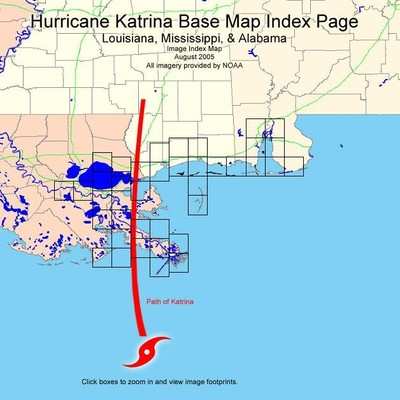
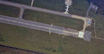
Flown on a rigorous number of high-resolution photo passes at 7500 feet, the photo paths are now being posted online by NOAA so that people can inspect areas of interest, in order to judge the extent of damage and flooding still in the area.

The entire area has yet to be fully photographed, but affected parties have been advised to use these maps in an effort to find their respective neighborhoods and that updates will be posted as soon as they are available.

The maps have been segmented into a multitude of areas with small rectangles signifying the photo paths taken by the Cessna. Users then click on the small black boxes, approximating their area of interest, to zoom to the overhead pictures and/or use the back button in their Internet browser to return to the main map to select other maps and photos.

FMI: http://ngs.woc.noaa.gov/katrina/KATRINA0000.HTM

Advertisement

More News

Unfortunate... ANN/SportPlane Resource Guide Adds To Cautionary Advisories

The Industry Continues to be Rocked By Some Questionable Operations Recent investigations and a great deal of data has resulted in ANN’s SportPlane Resource Guide’s rep>[...]

ANN FAQ: Turn On Post Notifications

Make Sure You NEVER Miss A New Story From Aero-News Network Do you ever feel like you never see posts from a certain person or page on Facebook or Instagram? Here’s how you c>[...]

ANN's Daily Aero-Term (04.29.24): Visual Approach Slope Indicator (VASI)

Visual Approach Slope Indicator (VASI) An airport lighting facility providing vertical visual approach slope guidance to aircraft during approach to landing by radiating a directio>[...]

ANN's Daily Aero-Term (04.28.24): Airport Marking Aids

Airport Marking Aids Markings used on runway and taxiway surfaces to identify a specific runway, a runway threshold, a centerline, a hold line, etc. A runway should be marked in ac>[...]

ANN's Daily Aero-Linx (04.28.24)

Aero Linx: The Skyhawk Association The Skyhawk Association is a non-profit organization founded by former Skyhawk Pilots which is open to anyone with an affinity for the A-4 Skyhaw>[...]

blog comments powered by Disqus


Advertisement

Advertisement

Podcasts

Advertisement

© 2007 - 2024 Web Development & Design by Pauli Systems, LC