Sat, Oct 05, 2013
FltPlan Go Based On Company's Legacy App
FltPlan.com has rolled out a new, free FltPlan Go iPad app. FltPlan Go is the latest addition to the variety of powerful tools available for pre-flight, in-flight and post-flight. The new FltPlan Go app is also the platform on which the company says many "great" new features will be added.
The existing FltPlan.com Legacy app was originally created four years ago to provide pilots with airport information and approach charts. As pilots' in-flight needs grew, the Legacy app continued to add more features and functionality. The company said in a news release that "in order to continue to add more capabilities, we felt that it was better to start over with an improved platform, so we developed FltPlan Go."
Among the new features on FltPlan Go are:
- Rubber banding for flight planning
- Ability to create and edit routes offline
- Breadcrumbs - leaves a trail of where you have been on the screen
- XM - WX capabilities from Baron Weather
- ADS-B weather and traffic using Sagetech Clarity receiver
- Geo-Referenced Taxi Charts
- Geo-Referenced IFR Approach Charts
- Helicopter Routes, TAC Charts
- Graphical SUAs (Special Use Airspace) for offline use
- Multiple binders for easy access to the info you need
- Ability to save notes and highlight on multiple Approach Charts
- Enhanced FBO information
- Current fuel prices
- Downloadable street map for offline viewing
The new features are in addition to those already available on the FltPlan 'Legacy' app:
- Moving maps for High & Low IFR Enroute Charts for the U.S., Canada, Mexico and Caribbean
- IFR Approach Charts for the U.S. and Canada
- Document storage and document sharing
- Weight & Balance
- Downloadable NavLog & Weather
- Integration with the FltPlan.com website
- Weather & TFR overlay
- A/FD
In the coming weeks, the company says it will also be migrating many of the features from our previous FltPlan Legacy app over to FltPlan Go, like our eLogbook program, Runway Wind Calculator, Density Altitude Calculator, and Fuel Conversion. The FltPlan Legacy app will remain available.
The FltPlan Go app includes free Geo-Referenced Approach Charts. We are rolling out these charts as they are completed for specific regions of the country. Currently we have Geo-Referenced Approach Charts for the eastern half of the U.S. The western portion of the U.S. will be included in the coming weeks. Airport Taxi Diagrams are already available for the whole U.S. As on our FltPlan Legacy app, Canadian Approach charts and Enroute Charts are also part of our FltPlan Go app at no charge.
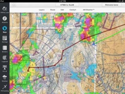
(Screenshot provided by FltPlan.com)
More News
Omnidirectional Approach Lighting System ODALS consists of seven omnidirectional flashing lights located in the approach area of a nonprecision runway. Five lights are located on t>[...]
"Polaris Dawn, the first of the program’s three human spaceflight missions, is targeted to launch to orbit no earlier than summer 2024. During the five-day mission, the crew >[...]
Also: 1800th E-Jet, Uncle Sam Sues For Landing Gear, Embraer Ag Plane, Textron Parts A friend of the family reported that Lt. Col. (Ret.) Richard Glenn Rutan flew west on Friday, M>[...]
Also: Virgin Galactic, B-29 Doc to Allentown, Erickson Fire-Fighters Bought, FAA Reauthorization After dealing with a big letdown after the unexpected decision by Skyreach to disco>[...]
“Our aircrews are trained and capable of rapidly shifting from operational missions to humanitarian roles. We planned to demonstrate how we, and our BORSTAR partners, respond>[...]
 ANN's Daily Aero-Term (05.05.24): Omnidirectional Approach Lighting System

