QinetiQ Completes First Flight Of UK Agricultural Monitoring UAV | Aero-News Network
Aero-News Network
RSS icon RSS feed
podcast icon MP3 podcast
Subscribe Aero-News e-mail Newsletter Subscribe

Airborne Unlimited -- Most Recent Daily Episodes

Episode Date

Airborne-Monday

Airborne-Tuesday

Airborne-Wednesday Airborne-Thursday

Airborne-Friday

Airborne On YouTube

Airborne-Unlimited-04.29.24

Airborne-NextGen-04.30.24

Airborne-Unlimited-05.01.24 Airborne-AffordableFlyers--05.02.24

Airborne-Unlimited-05.03.24

Fri, Aug 08, 2008

QinetiQ Completes First Flight Of UK Agricultural Monitoring UAV

U-MAP Program Aims To Monitor Land Suitability

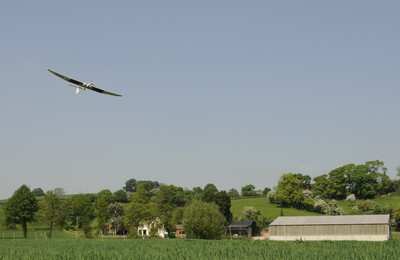
QinetiQ, working in partnership with Aberystwyth University's new biosciences centre IBERS, has successfully completed the UK's first flight of an autonomous unmanned aerial vehicle (UAV) for agricultural monitoring.

The flight was the culmination of phase one of the pioneering U-MAP program, a project supported by the Welsh Assembly Government. U-MAP (UAVs for Managing Agricultural Practice) has demonstrated the feasibility of using a UAV to deliver high resolution images to the agricultural, forestry and environmental monitoring sectors.

Farmers and foresters increasingly need accurate and timely information on the state of the land they occupy. For example by mapping the fertilizer requirements of arable crops, farmers can ensure they only apply the precise amount of fertilizer required, saving them money and preventing the pollution that occurs when nitrate fertilizers are over-applied.

The QinetiQ team acted as systems integrator for the specially adapted UAV platform and flew a total of more than 15 flights during the "work-up" phase and in support of data gathering. The UAV captured specialized video images that were used to create NDVI (normalised difference vegetation index) maps – sensitive indicators of the amount of vegetation present that can be used to determine fertilizer requirements.

"The UMAP project brings together emerging UAV technology with the growing need for farmers to fully understand the land they have under cultivation," commented Clive Richardson, Chief Operating Officer for QinetiQ's EMEA business. "With these recent flights we have successfully shown that UAVs are an affordable and flexible alternative to manned aircraft and satellites for the remote sensing of agricultural land."

FMI: www.qinetiq.com

Advertisement

More News

ANN's Daily Aero-Term (04.30.24): Runway Centerline Lighting

Runway Centerline Lighting Flush centerline lights spaced at 50-foot intervals beginning 75 feet from the landing threshold and extending to within 75 feet of the opposite end of t>[...]

ANN's Daily Aero-Linx (04.30.24)

Aero Linx: Air Force Global Strike Command Air Force Global Strike Command, activated August 7, 2009, is a major command with headquarters at Barksdale Air Force Base, Louisiana, i>[...]

Airborne 04.24.24: INTEGRAL E, Elixir USA, M700 RVSM

Also: Viasat-uAvionix, UL94 Fuel Investigation, AF Materiel Command, NTSB Safety Alert Norges Luftsportforbund chose Aura Aero's little 2-seater in electric trim for their next gli>[...]

Airborne 04.29.24: EAA B-25 Rides, Textron 2024, G700 Deliveries

Also: USCG Retires MH-65 Dolphins, Irish Aviation Authority, NATCA Warns FAA, Diamond DA42 AD This summer, history enthusiasts will have a unique opportunity to experience World Wa>[...]

Airborne-NextGen 04.23.24: UAVOS UVH 170, magni650 Engine, World eVTOL Directory

Also: Moya Delivery Drone, USMC Drone Pilot, Inversion RAY Reentry Vehicle, RapidFlight UAVOS has recently achieved a significant milestone in public safety and emergency services >[...]

blog comments powered by Disqus


Advertisement

Advertisement

Podcasts

Advertisement

© 2007 - 2024 Web Development & Design by Pauli Systems, LC