Three Days' Driving Goes Farther Than 70 Days In The Past
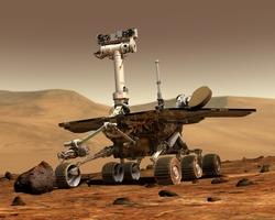 On three consecutive days, NASA's
Mars Exploration Rover Opportunity accomplished unprecedented feats
of martian motion, covering more total ground in that period than
either Opportunity or its twin, Spirit, did in their first 70 days
on Mars.
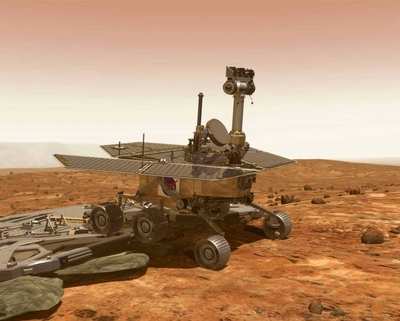
On three consecutive days, NASA's
Mars Exploration Rover Opportunity accomplished unprecedented feats
of martian motion, covering more total ground in that period than
either Opportunity or its twin, Spirit, did in their first 70 days
on Mars.
Spirit, meanwhile, has uncovered soil that is more than half
salt, adding to the evidence for Mars' wet past. The golf-cart-size
robots successfully completed their three-month primary missions in
April 2004 and are continuing extended mission operations.
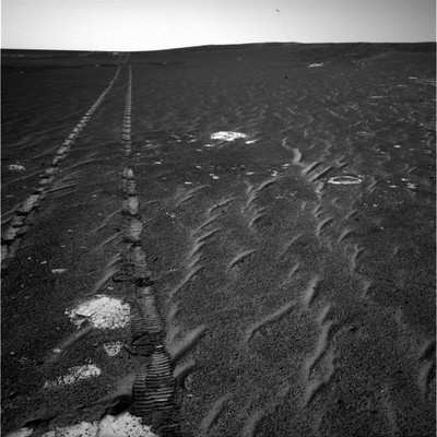
Opportunity set a one-day distance record for Martian driving,
177.5 meters (582 feet), on Feb. 19. That was the first day of a
three-day plan transmitted to the rover as a combined set of
weekend instructions. During the preceding week, engineers at
NASA's Jet Propulsion Laboratory had sent Opportunity and Spirit an
upgrade of the rovers' software, onboard intelligence the rovers
use for carrying out day-to-day commands.
The new record exceeded a two-week old former best by 13
percent. As on all previous long drives by either rover, the
traverse began with "blind" driving, in which the rover followed a
route determined in advance by rover planners at JPL using stereo
images. That portion lasted an hour and covered most of the day's
distance. Then Opportunity switched to "autonomous" driving for two
and a half hours, pausing every 2 meters (6.6 feet) to look ahead
for obstacles as it chose its own route ahead.
The next day, Opportunity used its new software to start another
drive navigating for itself. "This is the first time either rover
has picked up on a second day with continued autonomous driving,"
said Dr. Mark Maimone, rover mobility software engineer at JPL.
"It's good to sit back and let the rover do the driving for
us."
Not only did Opportunity avoid obstacles for four hours of
driving, it covered more ground than a football field. Opportunity
has a favorable power situation, due to relatively clean solar
panels and increasing minutes of daylight each day as spring
approaches in Mars' southern hemisphere. This allows several hours
of operations daily.
On the third day of the three-day plan, the robotic geologist
continued navigating itself and drove even farther, 109 meters (357
feet), pushing the three-day total to 390 meters (nearly a quarter
mile). In one long weekend, Opportunity covered a distance
equivalent to more than half of the 600 meters that had been part
of each rover's original mission-success criteria during their
first three months on Mars.
Opportunity has now driven 3,014 meters (1.87 miles) since
landing; Spirit even farther, 4,157 meters (2.58 miles).
Opportunity is heading south toward a rugged landscape called
"etched terrain," where it might find exposures of deeper layers of
bedrock than it has seen so far. Spirit is climbing "Husband Hill,"
with a pause on a ridge overlooking a valley north of the summit to
see whether any potential targets below warrant a side trip.
As Spirit struggled up the slope approaching the ridge line, the
rover's wheels churned up soil that grabbed scientists' attention.
"This was an absolutely serendipitous discovery," said Dr. Steve
Squyres of Cornell University, Ithaca, NY, principal investigator
for the rovers' science instruments. "We said, 'My gosh, that soil
looks very bright. Before we go away, we should at least take a
taste."
The bright patch of disturbed soil, dubbed "Paso Robles," has
the highest salt concentration of any rock or soil ever examined on
Mars. Combined information gained from inspecting it with Spirit's
three spectrometers and panoramic camera suggests its main
ingredient is an iron sulfate salt with water molecules bound into
the mineral. The soil patch is also rich in phosphorus, but not
otherwise like a high-phosphorus rock, called "Wishstone," that
Spirit examined in December. "We're still trying to work out what
this means, but clearly, with this much salt around, water had a
hand here," Squyres said.
Meanwhile, scientists are re-calibrating data from both rovers'
alpha particle X-ray spectrometers. These instruments are used to
assess targets' elemental composition. The sensor heads for the two
instruments were switched before launch. Therefore, data that
Opportunity's spectrometer has collected have been analyzed using
calibration files for Spirit's, and vice-versa. Fortunately,
because the sensor heads are nearly identical, the effect on the
elemental abundances determined by the instruments was very small.
The scientists have taken this opportunity to go back and review
the results for the mission so far and re-compute using correct
calibration files. "The effect in all cases was less than the
uncertainties in results, so none of our science conclusions are
affected," Squyres said.
 Unfortunate... ANN/SportPlane Resource Guide Adds To Cautionary Advisories

