Wed, Sep 11, 2019
Includes New VFR Flyway Charts
Steer clear of Bravo airspace and commercial traffic with new VFR planning charts included with the latest release of ForeFlight ... Version 11.7.
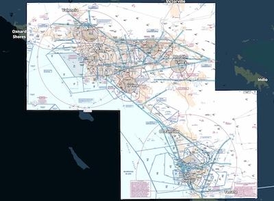
Download and view the FAA's newly georeferenced VFR Flyway Charts directly on ForeFlight’s map for improved VFR flight planning in big cities. The charts depict potential VFR routes through and around 19 major U.S. metropolitan areas, helping you circumvent Class B airspace and high-traffic areas and providing increased visual awareness.
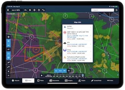
The new version also includes a number of improvements allow users to do more with map layers and the single-tap gesture. Enable multiple shape-based map layers like TFRs and AIR/SIGMET/CWAs simultaneously, then tap where they overlap to select which one you want to view information about. This multi-layer “Map Info” popup also allows you to select elements from other map layers like winds aloft barbs, PIREPS, lightning, obstacles, and Aeronautical Map elements like waypoints and airways. Users can also now tap on FBO markers that are built into ForeFlight’s Aeronautical Map airport diagrams to quickly access information about them.
Additionally, users can share aircraft profiles in ForeFlight with other pilots for easy collaboration when flight planning. Tap the Send To button while viewing an aircraft to share it via Airdrop, email, text, or any other messaging app. The recipient can then tap the link on their iPad or iPhone to accept the share. Shared aircraft are read-only, so recipients can't change any of the aircraft's details, but any changes made by the original owner are automatically synced to any recipients.
Recipients must be running ForeFlight version 11.7 or above to accept shared aircraft. Aircraft shared from a Performance Plus account to a non-Performance account will not include the ForeFlight Performance Profiles, as these are only available with Performance Plus.
ForeFlight customers in Europe can now view graphical enroute NOTAMs as part of the NOTAMs/TFRs map layer. ForeFlight uses geographic data contained in NOTAM descriptions to draw their actual shapes whenever possible, and color-codes NOTAMs gray, orange, or red based on increasing severity and type. Tap on each NOTAM to view its description and active times.
(Source: ForeFlight. Images provided)
More News
Aviation Governance Secured...At Least For a While The National Business Aviation Association similarly applauded the passage of the FAA's recent reauthorization, contentedly recou>[...]
Emphasis On Growing The Future of Aviation Through Concentration on 'AFFORDABLE FLYERS' It's been a number of years since the Latest Edition of Jim Campbell's HUGE SportPlane Resou>[...]
Amazilia Aerospace GmbH, Develops Digital Flight Control, Flight Guidance And Vehicle Management Systems Textron eAviation has acquired substantially all the assets of Amazilia Aer>[...]
Honeywell's Primus Brings New Tools and Niceties for Hawker Operators Hawker 4000 business jet operators have a new installation on the table, now that the FAA has granted an STC f>[...]
Company Celebrates Niche-but-Important Advancement in Industry Standards Echodyne has announced full integration of its proprietary 'EchoFlight' radar into the e American Aerospace>[...]
 Bolen Gives Congress a Rare Thumbs-Up

