Fri, Apr 10, 2015
A NextGen Aviation App That Provides Graphical Weather, Traffic, And Textual Data
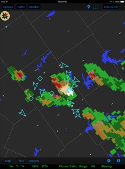
FreeFlight Systems announces the release of ADS-B View 2.0 - a free NextGen aviation iPad app that provides graphical weather, traffic, and textual data to the aircraft pilot and crew. Weather and traffic information is received by the RANGR ADS-B system, transmitted to the tablet via WiFi, and overlayed on the ADS-B View map.
"As with the previous version, and in keeping with the 'Free Weather and Traffic' philosophy of ADS-B, the app is available free of charge from the Apple store and works with any FreeFlight Systems ADS-B In system," said Tim Taylor, President and CEO of FreeFlight Systems.
The graphical weather can be placed into a looping mode so that weather changes can be viewed over time. The map can be configured to show runways, roads, lakes, and state and county lines. Bookmarks allow the user to easily return to previously viewed areas. The user can select a freely-scrollable map view, or have the aircraft remain centered on the map either North-up or Track-up. In addition, textual information, such as METARs, is provided.
ADS-B View version 2.0 offers the ability for user selection of an ownship position source, a new graphics engine, and additional support. Selection of an ownship position source allows users with an installed RANGR system to use the internal WAAS/GPS to drive the position source on their iPad. Users also have the option choose external Bluetooth GPS data depending on personal preference.
The new graphics engine provides increased responsiveness to user interaction, including smoother scrolling and full map rotation capability. Additional connectivity support allows for fewer disruptions when connectivity between the tablet and the transceiver is poor. It also enables multiple tablets to connect to the same transceiver, which was not supported by ADS-B View 1.0.
ADS-B View can be downloaded from the Apple App Store. Current ADS-B View users simply need to update their existing app to receive the benefits of the newest version.
(Image provided by FreeFlight Systems)
More News
Touchdown Zone Lighting Two rows of transverse light bars located symmetrically about the runway centerline normally at 100 foot intervals. The basic system extends 3,000 feet alon>[...]
“Discovery and innovation are central to our mission at Virgin Galactic. We’re excited to build on our successful record of facilitating scientific experiments in subor>[...]
"We are reaching out to you today on behalf of the Popular Rotorcraft Association because we need your help. We are dangerously close to losing a critical resource that if lost, wi>[...]
UAS Traffic Management (UTM) The unmanned aircraft traffic management ecosystem that will allow multiple low altitude BVLOS operations and which is separate from, but complementary>[...]
Aero Linx: Society of Aviation and Flight Educators (SAFE) SAFE is a member-oriented organization of aviation educators fostering professionalism and excellence in aviation through>[...]
 ANN's Daily Aero-Term (05.02.24): Touchdown Zone Lighting

