FAA Launches National Capital Region No Drone Zone Campaign | Aero-News Network
Aero-News Network
RSS icon RSS feed
podcast icon MP3 podcast
Subscribe Aero-News e-mail Newsletter Subscribe

Airborne Unlimited -- Most Recent Daily Episodes

Episode Date

Airborne-Monday

Airborne-Tuesday

Airborne-Wednesday Airborne-Thursday

Airborne-Friday

Airborne On YouTube

Airborne-Unlimited-10.28.24

Airborne-NextGen-10.29.24

Airborne-Unlimited-10.30.24

Airborne-Unlimited-10.24.24

Airborne-Unlimited-10.25.24

Thu, May 14, 2015

FAA Launches National Capital Region No Drone Zone Campaign

Aim Is To Educate The Public About The Prohibition Against UAV Flights In D.C., Near National Airport

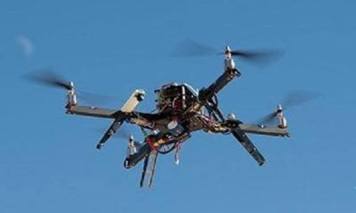
The FAA has announced a public outreach campaign for the National Capital Region around Washington, D.C. to reinforce the message that the District of Columbia and cities and towns within a 15-mile radius of Ronald-Reagan Washington National Airport are a No Drone Zone.

“Federal rules prohibit any aircraft from operating in the Flight Restricted Zone around our nation’s capital without specific approval,” said U.S. Transportation Secretary Anthony Foxx. “That includes all unmanned aircraft.”

The FAA is making outreach materials available to other federal, state and local partners around the National Capital Region to ensure that residents and tourists all understand that operating an unmanned aircraft in this area for any purpose is against the law.

The airspace around Washington, D.C. is more restricted than in any other part of the country. Rules put in place after the 9/11 attacks establish “national defense airspace” over the area and limit aircraft operations to those with an FAA and Transportation Security Administration authorization. Violators face stiff fines and criminal penalties.

“Anyone visiting the DC area should leave their drone at home,” said FAA Administrator Michael Huerta. “We want to make sure everyone knows and understands the rules about flying in the National Capital Region.”

As part of its public education efforts, the FAA is developing a GPS-driven smartphone app to tell recreational unmanned aircraft operators where they can and cannot legally operate. The FAA expects to release the app for Apple devices later this year after beta testing is complete.

FMI: www.faa.gov

Advertisement

More News

Senator Pushes FAA to Accelerate Rocket Launch Licensing

States That Current Process is Damaging National Aerospace Development US Senator Jerry Morgan is pushing the FAA to speed up the process for rocket launch licensing. He argues tha>[...]

Classic Aero-TV: RJ Gritter - Part of Aviation’s Bright New Future

From 2015 (YouTube Edition): Model Aviator Aims For Full-Scale Career While at the 2015 Indoor Electric RC Festival, referred to as eFest, ANN CEO and Editor-In-Chief, Jim Campbell>[...]

Aero-FAQ: Dave Juwel's Aviation Marketing Stories -- ITBOA BNITBOB

Dave Juwel's Aviation Marketing Stories ITBOA BNITBOB ... what does that mean? It's not gibberish, it's a lengthy acronym for "In The Business Of Aviation ... But Not In The Busine>[...]

ANN's Daily Aero-Linx (10.27.24)

Aero Linx: Cardinal Flyers Online The Cardinal Flyers Online Web site was created and is maintained by me, Keith Peterson. My wife Debbie and I have owned a 1976 RG since 1985. Wit>[...]

ANN's Daily Aero-Term (10.27.24): Clearance Void If Not Off By (Time)

Clearance Void If Not Off By (Time) Used by ATC to advise an aircraft that the departure release is automatically canceled if takeoff is not made prior to a specified time. The exp>[...]

blog comments powered by Disqus


Advertisement

Advertisement

Podcasts

Advertisement

© 2007 - 2024 Web Development & Design by Pauli Systems, LC