Twenty Flights Scheduled For Friday
Civil Air Patrol wings in the organization’s Northeast Region planned to make 16 flights Thursday and 20 more on Friday to continue assessing damage from Hurricane Sandy, with aircrews also looking for people possible stranded in deep snow in West Virginia. The flights follow 25 damage assessment sorties carried out Tuesday and Wednesday. The first aerial missions took place Tuesday as soon as winds subsided sufficiently, as aircrews photographed damage to the coastal areas of Massachusetts, New Jersey, New York and Rhode Island, along with Massachusetts’ Martha’s Vineyard and Nantucket Island and Rhode Island’s Block Island.

CAP members also conducted flights over Maryland and Delaware in CAP’s neighboring Middle East Region, which includes West Virginia. “It’s a large cooperative effort between the Northeast Region and Middle East Region,” said Lt. Col. Paul Ghiron, Northeast Region director of emergency services.
The Northeast Region mobilized aircrews and other personnel before Sandy struck the northeast coast, launching two flights over Connecticut and Rhode Island, staffing emergency operations centers in each state, sending liaison officers to three Federal Emergency Management Agency regions, staffing the New York City Joint Emergency Management Center and helping the Red Cross load supplies onto trucks in New York. “We expect to do hundreds of sorties and obtain thousands of images for FEMA,” he said.
The region’s central command post in New Hampshire is pulling aircrews from all nine CAP wings – Connecticut, Maine, Massachusetts, New Hampshire, New Jersey, New York, Pennsylvania, Rhode Island and Vermont – in the Northeast Region, Ghiron said. Hundreds of members are involved in the air and on the ground, including officers and cadets providing assistance to Red Cross shelters in New York and New Jersey.
The storm’s impact varied widely from state to state.
In Rhode Island, “there are whole houses completely moved and places were houses are no longer there,” said the wing’s commander, Col. Benjamin Emerick. “There are a lot of boats mixed in, too.” His wing has “been flying the past two days, in between the bad weather bands,” Emerick said. The Rhode Island Wing has been averaging 3½ flights a day, with multiple aircrews using the wing’s lone CAP plane Tuesday and Wednesday and generating about 600-700 digital damage assessment photos of the state’s storm-battered coastline, he said.
Wednesday morning, he said, FEMA’s director of operations for the state received a bird’s-eye view of the coastline courtesy of one aircrew. In addition, aircrew members have used one of the Rhode Island National Guard’s Geospatial Information Interoperability Exploitation Portable kits to provide live video of portions of the flights to the state Emergency Operations Center. The Maine Wing’s aerial missions actually began a few days before the storm neared, with two flights carried out Sunday to supply 63 aerial photos of the state’s coastline south of Portland.
“The state was pretty proactive,” said the wing’s commander, Col. Dan Leclair said. “That way, they would know the extent of the damage.”
Minimal damage was also reported in New Hampshire, where the wing flew a mission Wednesday to evaluate the impact on forested areas of the state.
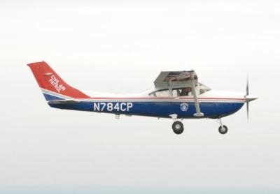
(CAP C182 file photo courtesy Civil Air Patrol)
 Sierra Space Repositions Dream Chaser for First Mission
 ANN's Daily Aero-Term (05.10.24): Takeoff Roll
 Aero-News: Quote of the Day (05.10.24)
 Aero-News: Quote of the Day (05.11.24)
 ANN's Daily Aero-Term (05.11.24): IDENT Feature


