Thu, Sep 08, 2022
Drone Usage Expands To Archeology As Students Map Ancient Cities
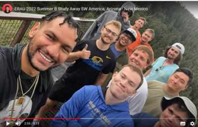
Two professors and 14 Embry-Riddle Aeronautical University (ERAU) students, graduates, and undergraduates of the Unmanned Aircraft Systems (UAS) program took a service-learning trip with drone in tow, to New Mexico and Arizona this summer, to work with archeologists in mapping ancient cities!
Their mission was to collect virtual data on a variety of locations using thermal infrared, LiDAR, multispectral and visible light systems of their drones. They also were eligible to earn up to nine credit hours for the project, working as part of a Study America Program through Embry-Riddle’s Office of Global Engagement.
“The main purpose was to give students studying UAS a real-world experience that meets a need,” added Dr. Macchiarella, a professor. “UAS brings a new aerial perspective to remote sensing. We can achieve levels of detail that exceed the best Google Earth images by a factor of over 25.” In recent years, drone use has increased, and manufacturers are always seeking out new use-cases for their products.
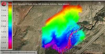
This particular use case offers several noteworthy advantages; to the archeological team in the collection and organization of the imagery; permitting physically challenged individuals to actively participate in the exploration; the ability to efficiently cover a lot of real-estate; provide previously unavailable vantage points (birds eye view) of the immediate surface and below via LiDAR and multispectral technology, and last but certainly not least, preserve the area for as long as possible before digging begins! Indiana Jones, where are you!?
As Dr. Macchiarella stated “It’s stunning to know that ancient people were making drawings here in North America that long ago. In many ways, these petroglyphs are mysterious. Some depict elements of everyday life, like animals; others are very abstract, with the true meanings lost to time." That hands-on, real-world aspect of the work is what initially attracted the students to participate, and faculty advisor Kevin Adkins, from the College of Aviation, emphasized the impacts that type of experience can have on students’ career searches after graduation.
More News
From 2023 (YouTube Edition): "Ain’t Your Daddy’s Super Cub”—Don Wade Co-owned by Don and Ron Wade—the former of Don’s Dream Machines, a storied >[...]
Pilot-Rated Passenger Reported That The Pilot Did Not Adequately “Round Out” The Landing Flare And The Airplane Bounced And Yawed To The Right Analysis: The pilot state>[...]
Dead Reckoning Dead reckoning, as applied to flying, is the navigation of an airplane solely by means of computations based on airspeed, course, heading, wind direction, and speed,>[...]
Aero Linx: Lake Amphibian Club This website is created and sponsored by the Lake Amphibian Club, to help spread the word about these wonderful, versatile amphibians that can land j>[...]
“I am deeply honored to be sworn in as NASA administrator. NASA’s mission is as imperative and urgent as ever — to push the boundaries of human exploration, ignit>[...]
 Classic Aero-TV: In Praise of Alabamas Patriot Aircraft USA

