Wed, Feb 02, 2011
2011 Bahamas & Caribbean Pilot's Guide Now On The Popular
Tablet
While you may go to the islands to get away from "it all,"
there's still a good reason to slip your iPad into your flight bag
... the 2011 Bahamas & Caribbean Pilot's Guide.

The downloadable app gives subscribers access to a search
feature which lets you easily find what you're looking for. The
searchable index lets you run down through the island chains to
find the island or airport you want. The bookmark feature lets you
keep track of your favorites. And then there are the photos.
The Bahamas & Caribbean Pilot's Guide has been updated and
published every year since 1979. After 33 years in print, the
Bahamas & Caribbean Pilot's Guide remains the only
single-source reference for island travel. The Guide has complete
airport information for the entire Bahamas & Caribbean region,
as well as island and travel information. Sections include General
Information and procedures, Islands of the Bahamas, Turks &
Caicos, Hispaniola/Cuba, Western Caribbean (Cayman Islands,
Jamaica, Yucatan, Belize and Roatan), Puerto Rico & U.S. and
British Virgin Islands, Eastern Caribbean (Anguilla south to Aruba,
Bonaire, Curacao), United States (Florida Airports of Entry) and
Survival.
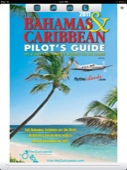
The Pilot's Guide is packed full of color photos, including an
aerial photo of every airport in the Bahamas & Caribbean.
Everything a pilot needs to know is included: phone numbers for
airport managers and Customs & Immigration, frequencies, fuel
availability, runway details, hours, procedures, GPS designators as
well as longs & lats (a necessity to find some of the small
airports that won't be in your GPS database.) The general
information section covers customs, flight plans, forms,
procedures, and required equipment in great detail. You don't have
to spend hours on the web to glean bits and pieces of information -
it's all right here in one beautiful application with nearly a
thousand color photos! It's a must-have in the cockpit as you fly
through the islands. You'll be able to identify airports by the
aerial photographs as you fly over them - the pictures really are
worth a thousand words. With extensive accommodations and
recreational details and phone numbers, this book also helps you
plan where to go, where to stay and what to do.
More News
Aero Linx: Aviators Code Initiative (ACI) Innovative tools advancing aviation safety and offering a vision of excellence for aviators. The ACI materials are for use by aviation pra>[...]
Make Sure You NEVER Miss A New Story From Aero-News Network Do you ever feel like you never see posts from a certain person or page on Facebook or Instagram? Here’s how you c>[...]
From 2016 (YouTube Edition): Who You Gonna Call When You Have a Rocket Engine that Needs a Spacecraft? While at EAA AirVenture 2016, ANN CEO and Editor-In-Chief, Jim Campbell, sat >[...]
"In my opinion, if this isn't an excessive fine, I don't know what is... The odds are good that we're gonna be seeking review in the United States Supreme Court. So we gotta muster>[...]
Expedite Used by ATC when prompt compliance is required to avoid the development of an imminent situation. Expedite climb/descent normally indicates to a pilot that the approximate>[...]
 ANN's Daily Aero-Linx (04.30.25)