Controller Issued Repeated Low Altitude Warnings
 Editor's
Note: Below is the National Transportation Safety
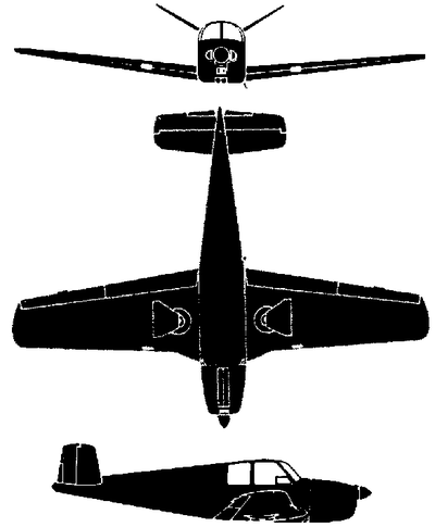
Board's preliminary report on the August 12 downing of a Beechcraft
G35 Bonanza near Boston, MA.
As ANN reported, the pilot and his two
passengers onboard were killed when the aircraft spiraled out of
the clouds, and impacted a strip mall parking lot...
NTSB Identification: MIA08FA163
14 CFR Part 91: General Aviation
Accident occurred Tuesday, August 12, 2008 in South Easton,
MA
Aircraft: Beech G35, registration: N4615D
Injuries: 3 Fatal.
This is preliminary information,
subject to change, and may contain errors. Any errors in this
report will be corrected when the final report has been
completed.
On August 12, 2008, about 1017 eastern
daylight time, a Beech G35, N4615D, registered to a private
individual, operated by the pilot as "Angel Flight 15 Delta"
experienced an in-flight loss of control while maneuvering to
re-intercept a localizer, and then crashed into a parking lot of a
shopping center located in South Easton, Massachusetts. Instrument
meteorological conditions prevailed at the time and an instrument
flight rules (IFR) flight plan was filed for the 14 Code of Federal
Regulations (CFR) Part 91 personal flight that departed Francis S.
Gabreski Airport (FOK), Westhampton, New York, about 0910, destined
for General Edward Lawrence Logan International Airport (BOS),
Boston, Massachusetts. The airplane was destroyed, and the
certificated commercial pilot and the two passengers were
killed.
The purpose of the flight was to
transport the passengers to BOS for planned medical treatment in
the area. The pilot was a volunteer pilot for Angel Flight
Northeast, which coordinated the flight. According to preliminary
air traffic control (ATC) communications, after takeoff the flight
proceeded towards BOS. About 1008, when the flight was
approximately 10 nautical miles southwest of BOS flying at 5,000
feet, the pilot established contact with Boston Terminal Radar
Approach Control (Boston TRACON) and advised he was turning right
to heading 210 degrees. Recorded radar data depicted the airplane
flying on a south-southwesterly heading, and about 1010, the
controller instructed the pilot to turn 10 degrees to the right and
descend to 4,000 feet, which was acknowledged. The controller then
asked the pilot what speed he could maintain on final approach
until reaching the outer marker. The pilot advised 130 knots, but
added that he would have to slow when the flight was closer in. The
flight continued on a south-southwesterly heading, and while
descending to 4,000 feet, accelerated to approximately 170 knots
ground speed.
The flight descended to 4,000 feet,
and about 1013, when the flight was approximately 21 nautical miles
southwest of BOS, the controller instructed the pilot to turn to
heading 170 degrees, which was acknowledged. The controller then
instructed the pilot to turn to heading 130 degrees, which was also
acknowledged. Recorded radar data reflects the turn towards the
southeast, and the pilot was then instructed to descend and
maintain 3,000 feet, which was acknowledged. About 1014, when the
flight was at 3,600 feet and approximately 1.3 nautical mile
northwest of the localizer at 170 knots ground speed, the
controller instructed the pilot to turn left heading 060 degrees
and to intercept the localizer. The pilot acknowledged the
instructions and recorded data indicates the flight turned to the
left but crossed the localizer. About 1016, the controller advised
the pilot that he had passed thru the localizer and to turn left
heading 010 degrees to intercept the localizer. The pilot responded
with "15 Delta."
After the pilot's truncated
transmission, radar data indicated the flight turned to a heading
of approximately 320 degrees and descended to 2,700 feet while
flying towards the localizer. About 1017, the controller asked the
pilot if he was joining the localizer; there was no response. The
controller then advised the pilot that the altitude indicated 2,300
feet, then immediately informed him radar contact was lost. The
controller then repeated the airplane's call sign and the pilot
responded "5 Delta's with you." The controller advised the pilot
that the airplane was at 1,200 feet, issued a low altitude alert,
and instructed the pilot twice to "climb immediately." The pilot
responded "5 Delta's climbing." The controller advised the pilot to
maintain 3,000 feet; and to state his heading; a very short
unintelligible transmission was heard. The recorded radar data
indicated that the flight climbed to 2,700 feet at a ground speed
of 85 knots. The controller again instructed the pilot to maintain
3,000 feet and to state heading; there was no response. The
recorded radar data indicated the airplane then descended to 2,400
feet at a ground speed of 68 knots. There were no further radar
returns with altitude depicted. The controller then broadcasted
that "your altitude is going up and down are [you] all right sir."
There was no response. The controller then issued a low altitude
alert again, instructed the pilot to climb immediately, and that
radar contact was lost. The controller asked nearby aircraft if
they heard a signal from an emergency locator transmitter (ELT); no
signal was heard.
 A pilot-rated witness
who was located .41 nautical mile and 288 degrees from the crash
site reported hearing a low flying airplane, heading west to east,
with high rpm. He ran outside but did not see the airplane. The
noise faded then returned, and he observed the airplane descending
vertically out of the clouds. The witness's first view of the
airplane was the top of the airplane. He did not recall if he saw
the landing gear, but did not see any smoke trailing the airplane
during the time he saw it. The airplane spun 2.5 times to the left,
went out of sight behind trees, and he heard an impact and saw
smoke. He drove to the scene arriving there about 1 minute later.
The witness added that the engine was running with a constant sound
prior to impact, and that there was no missing or sputtering. The
weather conditions at the time consisted of a ceiling at 800 feet,
with no rain or wind.
Another witness who was on Route 106
reported to law enforcement seeing the airplane climbing and
descending from the clouds. A witness who was located on the roof
of a nearby store reported to law enforcement seeing the airplane
flying low between their location and another nearby building.
Numerous witnesses also reported to local law enforcement seeing
the airplane circling and then nose diving into the parking
lot.
The airplane impacted a parking lot
during daylight conditions; the crash site was located
approximately 212 degrees and 21 nautical miles from the center of
BOS. There were no ground injuries or reported damage to any
vehicles or equipment located in the parking lot.
A surface weather observation taken at
BOS at 1015, or approximately 2 minutes before the accident,
indicated the wind was from 350 degrees at 8 knots with gusts to 14
knots, the visibility was 8 statute miles with light rain, broken
clouds existed at 1,100 and 2,000 feet, overcast clouds existed at
5,500 feet, the temperature and dew point were 17 and 15 degrees
Celsius respectively, and the altimeter setting was 29.70 inches of
mercury.
 NTSB Final Report: Cozy Cub
 ANN FAQ: Contributing To Aero-TV
 Classic Aero-TV: Seated On The Edge Of Forever -- A PPC's Bird's Eye View
 ANN's Daily Aero-Linx (04.29.25)
 ANN's Daily Aero-Term (04.29.25): Execute Missed Approach


