FAA Launches National Capital Region No Drone Zone Campaign | Aero-News Network
Aero-News Network
RSS icon RSS feed
podcast icon MP3 podcast
Subscribe Aero-News e-mail Newsletter Subscribe

Airborne Unlimited -- Most Recent Daily Episodes

Episode Date

Airborne-Monday

Airborne-Tuesday

Airborne-Wednesday Airborne-Thursday

Airborne-Friday

Airborne On YouTube

Airborne-Unlimited-07.07.25

Airborne-NextGen-07.08.25

AirborneUnlimited-07.09.25

Airborne-FlightTraining-07.10.25

AirborneUnlimited-07.11.25

Thu, May 14, 2015

FAA Launches National Capital Region No Drone Zone Campaign

Aim Is To Educate The Public About The Prohibition Against UAV Flights In D.C., Near National Airport

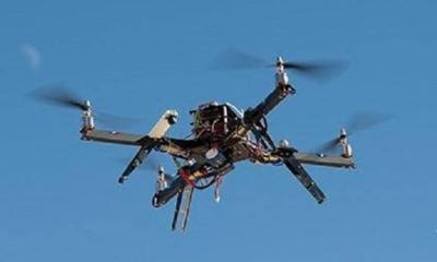
The FAA has announced a public outreach campaign for the National Capital Region around Washington, D.C. to reinforce the message that the District of Columbia and cities and towns within a 15-mile radius of Ronald-Reagan Washington National Airport are a No Drone Zone.

“Federal rules prohibit any aircraft from operating in the Flight Restricted Zone around our nation’s capital without specific approval,” said U.S. Transportation Secretary Anthony Foxx. “That includes all unmanned aircraft.”

The FAA is making outreach materials available to other federal, state and local partners around the National Capital Region to ensure that residents and tourists all understand that operating an unmanned aircraft in this area for any purpose is against the law.

The airspace around Washington, D.C. is more restricted than in any other part of the country. Rules put in place after the 9/11 attacks establish “national defense airspace” over the area and limit aircraft operations to those with an FAA and Transportation Security Administration authorization. Violators face stiff fines and criminal penalties.

“Anyone visiting the DC area should leave their drone at home,” said FAA Administrator Michael Huerta. “We want to make sure everyone knows and understands the rules about flying in the National Capital Region.”

As part of its public education efforts, the FAA is developing a GPS-driven smartphone app to tell recreational unmanned aircraft operators where they can and cannot legally operate. The FAA expects to release the app for Apple devices later this year after beta testing is complete.

FMI: www.faa.gov

Advertisement

More News

Aero-News: Quote of the Day (07.11.25)

“Honored to accept this mission. Time to take over space. Let’s launch.” Source: SecTrans Sean Duffy commenting after President Donald Trump appointed U.S. Secret>[...]

ANN's Daily Aero-Term (07.11.25): Permanent Echo

Permanent Echo Radar signals reflected from fixed objects on the earth's surface; e.g., buildings, towers, terrain. Permanent echoes are distinguished from “ground clutter&rd>[...]

ANN's Daily Aero-Linx (07.11.25)

Aero Linx: European Hang Gliding and Paragliding Union (EHPU) The general aim of the EHPU is to promote and protect hang gliding and paragliding in Europe. In order to achieve this>[...]

NTSB Final Report: Schweizer SGS 2-33A

Glider Encountered A Loss Of Lift And There Was Not Sufficient Altitude To Reach The Airport Analysis: The flight instructor reported that while turning final, the glider encounter>[...]

NTSB Prelim: Aeronca 7AC

Airplane Climbed To 100 Ft Above Ground Level, At Which Time The Airplane Experienced A Total Loss Of Engine Power On May 24, 2025, at 1300 eastern daylight time, an Aeronca 7AC, N>[...]

blog comments powered by Disqus


Advertisement

Advertisement

Podcasts

Advertisement

© 2007 - 2025 Web Development & Design by Pauli Systems, LC