The FAA has published more than 200 facility maps to streamline the commercial drone authorization process. The maps depict areas and altitudes near airports where UAS may operate safely. But drone operators still need FAA authorization to fly in those areas.

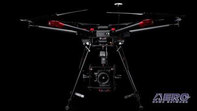
The maps will help drone operators improve the quality of their Part 107 airspace authorization requests and help the FAA process the requests more quickly. The maps are informational and do not give people permission to fly drones. Remote pilots must still submit an online airspace authorization application. DJI and Hasselblad have introduced the first 100-megapixel integrated drone imaging platform. The DJI M600 Pro drone, the Ronin-MX gimbal and the Hasselblad H6D-100c camera combine each company’s expertise to create a tool for precise, detailed and accurate aerial imaging. Professional drone users can continuously control camera operations in flight using the DJI GO app. The flight platform is the DJI M600 Pro drone, a six-rotor flight platform equipped with the powerful Lightbridge 2 transmission system, a dustproof propulsion system, and six Intelligent Flight Batteries. AUVSI and our "Airborne-Unmanned" program production team have finalized the schedule for their LIVE interview program
series for XPONENTIAL 2017, set for May 8-11 in Dallas, TX. The broadcast will be conducted, shared, and viewed as a live webcast as well as archived for future viewing and use. Following extensive coverage and archiving of the opening day's festivities, the Airborne/ANN crew will conduct multi-hour LIVE interview programs on May 9th between 1200 and 1500 CDT, and 1000-1300 CDT on May 10th. Each session will consist of over a dozen 10-15 minute interviews with the best and brightest of XPONENTIAL 2017, offered LIVE via www.airborne-live.net and also capable of being included/embedded on webpages throughout cyberspace. A strong social media program will support the effort via #XPO17-Live. All this -- and MORE in today's episode of Airborne-Unmanned!!!
Airborne-Unmanned 05.02.17 is chock full of info in this Weekly News Episode, Tuesday, May 2nd, 2017... Presented by Aero-TV veteran videographer and Airborne Hosts Brianne Cross, Christopher Odom, and Laura Hutson, and is supported by ANN CEO/Editor-In-Chief Jim Campbell, Chief Videographer Nathan Cremisino, and Aero-Journalist Tom Patton, this episode covers:
- FAA Publishes First Set Of UAS Facility Maps
- DJI And Hasselblad Introduce 100-MP Integrated Aerial Photography Platform
- AUVSI and Aero-News Announce Live Webcast Schedules for XPONENTIAL 2017
- DJI Geofences Much Of Iraq And Syria
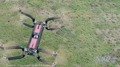
- GRIFF Aviation North America to Launch Assembly Plant in Florida to Build Its Heavy-Lift UAS
- uAvionix Announces Line Of Integrated ADS-B And GPS Solutions For Drones
- Coachella 2017: Drones As Art
Get Comprehensive, Real-Time, 24/7 coverage of the latest aviation and aerospace stories anytime, at aero-news.net. And be sure to join us again next week for the next edition of "Airborne-Unmanned" here on Aero-TV. Thanks for watching. See you, again, next week!
© 2017, Aero-News Network, Inc., ALL Rights Reserved.


 NTSB Final Report: Cozy Cub