Drone Power Line Inspection Begins In Nebraska | Aero-News Network
Aero-News Network
RSS icon RSS feed
podcast icon MP3 podcast
Subscribe Aero-News e-mail Newsletter Subscribe

Airborne Unlimited -- Most Recent Daily Episodes

Episode Date

Airborne-Monday

Airborne-Tuesday

Airborne-Wednesday Airborne-Thursday

Airborne-Friday

Airborne On YouTube

Airborne-Unlimited-05.13.24

Airborne-NextGen-05.07.24

Airborne-Unlimited-05.08.24 Airborne-FlightTraining-05.09.24

Airborne-Unlimited-05.10.24

Wed, Feb 12, 2020

Drone Power Line Inspection Begins In Nebraska

Aircraft Will Be Used To Take Photos Of Structures Along A High-Powered Transmission Line

Residents in northeast Nebraska may be seeing some drones flying around, as inspection work begins on a Nebraska Public Power District (NPPD) transmission line that extends from north of Norfolk, through Pierce County and into Antelope County.

Work is scheduled to begin Feb. 10, when drones will be used to take photos of structures along the high-powered transmission line. The photos are being taken so that NPPD can assess any maintenance work that may need to be completed along the line.

NPPD’s contractor, Valmont Utility, a business segment of Valmont Industries, Inc., will be conducting the drone work over a period of approximately five weeks and will be utilizing up to two drones simultaneously.  

“We recently conducted similar work on a transmission line in Fillmore County, and as we begin drone work in Madison, Pierce and Antelope counties, we want people to be aware of what’s going on,” says NPPD T&D Construction and Maintenance Manager Scott Walz. “The drones will be flying along our transmission lines and will only be operating during daytime hours.”

The drones will not be operating until at least 30 minutes after sunrise and will finish operating at least 30 minutes before sunset.

“Valmont partners with our key utility customers to understand the conditions of the assets required for grid reliability,” says Angi Chamberlain, Director of Quality for Valmont Utility. “The use of drones, or UAS, to survey and monitor the conditions of existing utility infrastructure allows a minimally invasive method to quickly ensure assets are in compliance with the original specifications and will maintain structural integrity over their lifetime. This is the most effective way to monitor the reliability of these critical assets,” adds Chamberlain.

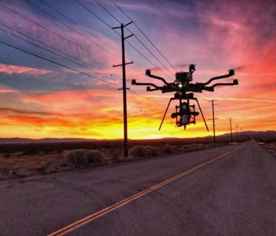
(Source: Nebraska Public Power District news release. Image from file)

FMI: www.nppd.com

Advertisement

More News

Bolen Gives Congress a Rare Thumbs-Up

Aviation Governance Secured...At Least For a While The National Business Aviation Association similarly applauded the passage of the FAA's recent reauthorization, contentedly recou>[...]

The SportPlane Resource Guide RETURNS!!!!

Emphasis On Growing The Future of Aviation Through Concentration on 'AFFORDABLE FLYERS' It's been a number of years since the Latest Edition of Jim Campbell's HUGE SportPlane Resou>[...]

Buying Sprees Continue: Textron eAviation Takes On Amazilia Aerospace

Amazilia Aerospace GmbH, Develops Digital Flight Control, Flight Guidance And Vehicle Management Systems Textron eAviation has acquired substantially all the assets of Amazilia Aer>[...]

Hawker 4000 Bizjets Gain Nav System, Data Link STC

Honeywell's Primus Brings New Tools and Niceties for Hawker Operators Hawker 4000 business jet operators have a new installation on the table, now that the FAA has granted an STC f>[...]

Echodyne Gets BVLOS Waiver for AiRanger Aircraft

Company Celebrates Niche-but-Important Advancement in Industry Standards Echodyne has announced full integration of its proprietary 'EchoFlight' radar into the e American Aerospace>[...]

blog comments powered by Disqus


Advertisement

Advertisement

Podcasts

Advertisement

© 2007 - 2024 Web Development & Design by Pauli Systems, LC