Complete With Weather Graphic Overlays, Up-To-The-Moment
TFRS
AOPA has just announced
the launch of a new, advanced, graphics-based flight-planning tool
with real-time graphic depictions of weather and temporary flight
restrictions.
"This is one of the most significant improvements AOPA has ever
made to our online Services," said AOPA President Phil Boyer. "Our
Real-Time Flight Planner brings click-and-drag simplicity to flight
planning. It offers advanced features utilizing the latest
technology from Jeppesen, but is a free service available to our
members.
"In today's security-driven flight environment, it's vital that
pilots have the most up-to-date information available," continued
Boyer. "Every time a member launches Real-Time Flight Planner, it
automatically downloads the latest TFR and navigation aid
information."
Members download a small application from AOPA Online (http://www.aopa.org/flight_planner/)
that interfaces with Real-Time Flight Planner. Once they've done
that, they may store a pilot profile, two aircraft profiles, and up
to five flight plans online, meaning that they can then use any
internet-capable computer that has the application installed to
access their information.
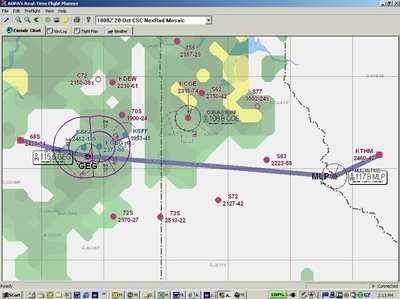
One of the flight planner's most useful features allows pilots
to easily alter routes around TFRs or weather by simply
"rubber-banding" the course to a new waypoint outside the affected
area.
Other features include:
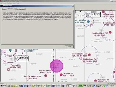
- Real-time TFR graphical overlay with current notams.
-
- Locate active TFRs and special use airspace (SUA) areas, then
rubber-band the route around them
- Rolling the cursor across a TFR or SUA depiction shows
altitudes and duration; double-clicking on the depiction pulls up
the textual notam description.
- Real-time weather map.
-
- Based on route, obtain weather briefing including radar
summaries and weather chart products from either DUATS provider,
then overlay route with current radar or satellite graphics for a
clear picture of weather along the way.
- Tap into AOPA's Airport Directory Online.
-
- Double-click on a landing facility for basic information and
links to the Airport Directory Online and current online instrument
approach procedures.
- Airport and approach procedure information can be printed out
in kneeboard format.
- Set level of detail on en route chart.
-
- Show state boundaries, cities, landing facilities, airways,
intersections, and navigation aids using zoom in/zoom out and
select/de-select tools
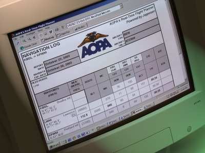
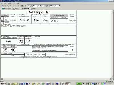
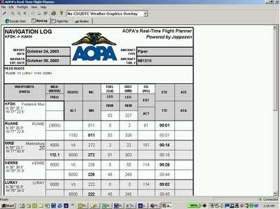
- Flight Plan and Navigation Log created automatically as route
is planned.
"AOPA is constantly striving to give its members the best tools
for flying safely," said Boyer. "And with Jeppesen providing the
aeronautical data and electronic charting, including real-time
graphical TFRs, pilots can plan with confidence."
AOPA is the world's largest civil aviation organization, with
more than 400,000 members. Since its founding at Philadelphia's
Wings Field 64 years ago, AOPA has been dedicated to keeping
general aviation fun, affordable, and above all, safe.
 Classic Aero-TV: In Praise of Alabamas Patriot Aircraft USA

