First Flight For A UAV Over A Fully Formed Hurricane
NASA completed a historic day for its hurricane research on
Thursday as it put the Global Hawk over Earl, marking the first
time the unmanned drone flew over a fully formed hurricane.

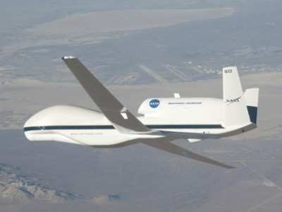
NASA Global Hawk UAV File Photo
The Global Hawk also flew in concert with NASA’s DC-8
during the DC-8’s fourth and final research flight to Earl.
Both planes are outfitted with a suite of highly advanced
instruments that scientists hope will bring new insight into how
hurricanes form and intensify.
Thursday marked the first day of the Genesis and Rapid
Intensification Processes (GRIP) experiment when two NASA aircraft
involved were flying and studying a storm at the same time. The
experiment was designed to take advantage of having multiple
aircraft above a storm at once, in order to observe hurricanes and
tropical storms in as many facets as possible.
As Earl changed over the course of the week, the hurricane
turned into an almost ideal test bed for GRIP. The DC-8 flew to
Earl four times, including twice from St. Croix in order to reach
it when it was farther east. GRIP scientists designed the mission
in order to capture a hurricane either as it was forming or as it
was strengthening or fizzling. And the Earl flights delivered,
allowing scientists to observe the storm rapidly intensifying
earlier in the week and then collapsing to a degree later in the
week.

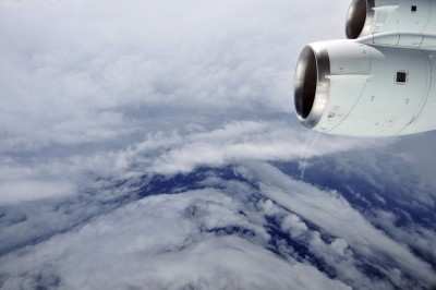
Hurricane Earl's Eye As Seen From NASA DC8 NASA
Image
A Sunday flight from St. Croix put the DC-8 over Earl as it
intensified from a Category 1 to a Category 2. And Monday’s
flight from Ft. Lauderdale allowed the DC-8’s instruments to
observe what was happening as Earl went from a Category 3 to a
Category 4. One of GRIP’s key goals is to help scientists
understand why and how some hurricanes rapidly intensify. These
flights collected important data toward that end, scientists
said.
“That series of flights alone really helped us achieve a
great goal, which is to observe rapid intensification,” said
GRIP mission scientist Scott Braun from NASA's Goddard Space Flight
Center, Greenbelt, MD.
Earl had surprised scientists earlier in the week when they saw
that it was surrounded by dry air. Hurricanes often derive strength
from moist air and weaken when dry air infiltrates the cyclone.
“What happened?” said GRIP mission scientist Ed Zipser
of the University of Utah. “The storm continued to intensify
in spite of that. And we need to know why.”
Then during Thursday’s flight, as Earl spun toward North
Carolina but also lost strength, GRIP scientists made measurements
from the storm as its eye wall collapsed and as it dropped from a
Category 3 to a Category 2 hurricane. At first blush, it appeared
that wind shear played a role in breaking up the storm. “It
doesn’t matter if it did what we thought it was going
to,” Zipser said. “It matters that it did something
interesting and that we were there to observe it.”
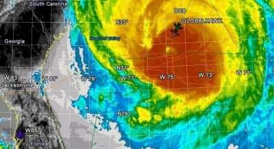
Tracking Hurricane Earl With Global Hawk NASA
Image
Now that the Global Hawk has successfully flown over an Atlantic
hurricane all the way from its base in southern California, the
GRIP team is hoping for more opportunities to put the
groundbreaking aircraft in the field. Because of the drone’s
30-hour flight range, it can remain directly over a storm to make
high-quality measurements far longer than a manned plane or a
satellite.
The GRIP mission will continue to fly until September 25th. So
scientists are hoping for more research opportunities like Earl
provided this week. “Yesterday’s flight was a historic
flight because we were able to put the Global Hawk over a hurricane
for the first time,” said Ramesh Kakar, GRIP program manager
from NASA Headquarters, Washington. “Earl has allowed us to
fulfill a lot of our objectives, but, we have almost a month to
go.”
 Aero-TV: DeltaHawks Diesel Power Steps Into the Spotlight
 NTSB Prelim: Mooney Aircraft Corp. M20K
 ANN FAQ: Turn On Post Notifications
 ANN's Daily Aero-Linx (12.20.25)
 Aero-News: Quote of the Day (12.20.25)
