Device Can Create 3-D Images In Near-Real Time, Maker Says
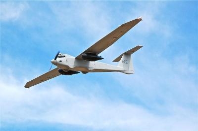
A sensor system designed to create 3-D reconstructions in near-real time and output high-resolution digital elevation models, LIDAR-like datasets, and wide area maps has been flown on an Arcturus UAV T-20 Tier II unmanned aerial vehicle. The system, called GeoDragon, is enclosed in a wing-mounted pod and is capable of high resolution 2-D and 3-D image capture.