Scientific Citation Probes Perimeter Of Volcanic Ash Cloud | Aero-News Network
Aero-News Network
RSS icon RSS feed
podcast icon MP3 podcast
Subscribe Aero-News e-mail Newsletter Subscribe

Airborne Unlimited -- Most Recent Daily Episodes

Episode Date

Airborne-Monday

Airborne-Tuesday

Airborne-Wednesday Airborne-Thursday

Airborne-Friday

Airborne On YouTube

Airborne-Unlimited-08.25.25

Airborne-NextGen-08.26.25

AirborneUnlimited-08.27.25

Airborne-AffordableFlyers-08.28.25

AirborneUnlimited-08.22.25

Wed, Apr 21, 2010

Scientific Citation Probes Perimeter Of Volcanic Ash Cloud

NLR Research Aircraft Used To Verify Movement Of The Cloud

The National Aerospace Laboratory's (NLR) research aircraft has investigated the volcanic ash cloud hovering over the Netherlands. The purpose of this flight was to verify the accuracy of atmospheric models currently being used to predict the movements of the ash cloud.

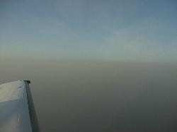
From the flight undertaken by the Cessna Citation on Sunday night above the Netherlands' southern provinces, it emerged that the ash cloud is highly visible. The edges of the ash cloud hovering above the country's southern provinces were also highly visible, which is crucial information for pilots when the air space is (temporarily) opened.

The objective of this flight was to verify the accuracy of the models the Royal Netherlands Meteorological Institute uses to calculate the movements of the volcanic ash cloud. These measurements are then used by the Dutch aviation authorities to take decisions regarding the closing and (re)opening of air space.

Sunday night's flight revealed that the models had accurately estimated the location of the volcanic ash layer. The NLR's research aircraft flew over the ash cloud, which at the time was hovering at a height of 1.8 miles and was comprised of varying thicknesses.


NLR Photo

There are very few methods currently available in Europe for precisely measuring and tracking volcanic ash. Moreover, there are no set regulations in place for determining which ash particle concentration levels necessitate the opening (or closing) of air space. NLR researchers are therefore currently working closely with other institutes, including the Royal Netherlands Meteorological Institute, the National Institute for Public Health and the Environment, the Dutch Ministry of Defence, the Ministry of Transport, Public Works and Water Management, and Eurocontrol. This joint research will determine the best methods for quickly and safely launching sensors and measuring instruments capable of accurately monitoring volcanic ash.

FMI: www.nlr.nl/smartsite.dws?l=en&id=8650, www.knmi.nl

Advertisement

More News

ANN's Daily Aero-Term (08.26.25): TRSA Service

TRSA Service This service provides, in addition to basic radar service, sequencing of all IFR and participating VFR aircraft to the primary airport and separation between all parti>[...]

ANN's Daily Aero-Linx (08.26.25)

Aero Linx: United Flying Octogenarians WELCOME to a most extraordinary group of aviators, the United Flying Octogenarians (UFO). Founded in 1982 with just a handful of pilots, we h>[...]

NTSB Final Report: Maule M7

(Pilot) Landed With A Quartering Tailwind On A Short Runway With Limited Go-Around Options Analysis: The pilot reported that he attempted to land at his home airstrip using a &ldqu>[...]

Classic Aero-TV: Team Aerostars - New Extras Upgrade Team's Performance

From 2019 (YouTube Edition): Yak 52s Have Been Replaced With Extra Aerobatic Airplanes For 2019 The Phillips 66 Aerostars have been performing together, side by side at around 250 >[...]

ANN FAQ: Submit a News Story!

Have A Story That NEEDS To Be Featured On Aero-News? Here’s How To Submit A Story To Our Team Some of the greatest new stories ANN has ever covered have been submitted by our>[...]

blog comments powered by Disqus


Advertisement

Advertisement

Podcasts

Advertisement

© 2007 - 2025 Web Development & Design by Pauli Systems, LC