Dart, Flight Management Systems, Partner To Provide Digital Maps | Aero-News Network
Aero-News Network
RSS icon RSS feed
podcast icon MP3 podcast
Subscribe Aero-News e-mail Newsletter Subscribe

Airborne Unlimited -- Most Recent Daily Episodes

Episode Date

Airborne-Monday

Airborne-Tuesday

Airborne-Wednesday Airborne-Thursday

Airborne-Friday

Airborne On YouTube

Airborne-Unlimited-10.07.24

Airborne-NextGen-10.08.24

Airborne-Unlimited-10.02.24

Airborne-AffordableFlyers-10.03.24

Airborne-Unlimited-10.04.24

Sat, Jan 09, 2010

Dart, Flight Management Systems, Partner To Provide Digital Maps

System Based On GIS Technology

Dart Helicopter Services (DHS) has announced a new distribution agreement with the Flight Management Systems (FMS). The relationship will allow DHS customers access to another useful helicopter accessory: digital moving maps.

“FMS is a leader in digital moving map technology,” said Jeff Shapiro, DHS President. “The relationship is a valuable addition for us. We are excited to be able to work with FMS to offer their map system to our customers.”

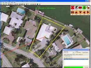
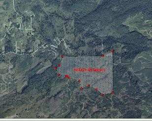
The moving map software utilizes geographic information systems (GIS) to offer more information than conventional scanned paper maps. In addition to being current, the technology enables a user to add as many layers of information as needed. Being able to view the location of potential hazards like cell phone towers and electrical wires, as well as helpful information like underground pipelines, and reverse 911 information, the map can enable the team to quickly and accurately identify a target address. Also, data gathered during a mission can be transferred to another system via USB, making information sharing simple.

“The entire FMS team is excited about the opportunities our relationship with DHS will bring.” FMS president Greg Taylor added “Although we have a presence in several global locations, we will be able to reach those in Europe, an area we haven’t serviced yet.”

FMS leadership has over 32 years of helicopter maintenance, police and aerial fire fighting experience and the company has been flying with the moving map technology since 1996, giving them the experience they need to make recommendations appropriate for any situation.

FMI: www.flightmanagementsystems.com, www.darths.com/

Advertisement

More News

ANN's Daily Aero-Term (10.06.24): Approach Speed

Approach Speed The recommended speed contained in aircraft manuals used by pilots when making an approach to landing. This speed will vary for different segments of an approach as >[...]

Aero-News: Quote of the Day (10.06.24)

“While on Combat Search and Rescue (CSAR) alert in East Africa, Pedro 11 Flight received a casualty evacuation request for two civilian children with life-sustaining injuries>[...]

Classic Aero-TV: David Uhl and the Lofty Art of Aircraft Portraiture

From 2022 (YouTube Edition): Still Life with Verve David Uhl was born into a family of engineers and artists—a backdrop conducive to his gleaning a keen appreciation for the >[...]

NTSB Final Report: Wonder Michael S Harmon Rocket

Pilot’s Routine Performance Of High-Speed Flyovers And Low-Altitude Aerobatics Was Indicative Of High-Risk Behavior Analysis: According to witnesses, the pilot took off and p>[...]

Aero-News: Quote of the Day (10.07.24)

“Dynon is committed to enhancing flight safety and reducing pilot workload. We’re thrilled to expand the SkyView HDX Autopilot to Mooney M20J and M20K pilots. This adva>[...]

blog comments powered by Disqus


Advertisement

Advertisement

Podcasts

Advertisement

© 2007 - 2024 Web Development & Design by Pauli Systems, LC