Fri, Mar 29, 2024
Melding Multiple Comms Channels Could Prove Key to Hassle-Free Drone Ops on the Frontier
uAvionix, has been awarded a Broad Agency Announcement contract from the FAA to "advance the commercial use of Uncrewed Aircraft Systems in the National Airspace System."
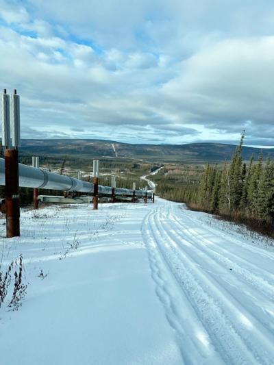
The contract looks to create a reliable command & control network for BVLOS ops across terrain with greater vertical development and variation than existing networks allow. To that end, uAvionix has joined hands with the University of Alaska Fairbanks UAS Test Site. They'll use that sandbox and begin mashing up their toys and tools, starting with their proprietary Link Executive Manager to fuse LTE, Iridium SATCOM, and C-Band communications links into a single, uninterrupted, reliable link to aircraft in flight. To make sure it's ready for real-world use, they'll put those drones to use flying the pipelines nearby. That's a nice bit of dual-use activity, those oil pipelines can always use a once-over to make sure the grizzlies aren't digging too deep. The end result will possibly become a foundational element of rural UAV operations.
“Reliance on a single link or common infrastructure isn’t always feasible in remote and mountainous terrain. Having multiple, seamless connections to the aircraft from airborne and ground-based communications provides the safety and flexibility needed to reliably perform these complex operations,” said Cyriel Kronenburg of uAvionix. “Flying for extended ranges with many transitions between communications paths and frequencies will provide the data needed to support FAA rule making and reinforce the concept that using UAS technology can be used safely and economically across all types of terrain and infrastructure."
The current practice for BVLOS ops requires significant hassles for operators, who have to gain an FAA waiver or exemption. Networks are generally reliant upon a single active command & control link, wit a single alternate to back them up. On the frontier, it's easy to see spotty service on multiple networks, tanking the waiver request's risk analysis before operations can even start. If uAvionix is successful, then everyone working on the fringe will gain an option that's much more operationally robust while ridding themselves of some paperwork along the way. Trustworthy, reliable systems are key for the near future of massed UAV flights across the land.
More News
Its Offerings Are Lighter, Cleaner, and Now Pushing Past 1,000nm on SAF Jet Fuel DeltaHawk’s diesel-powered aircraft lineup has seen incredible upgrades over the last few yea>[...]
The Airplane Experienced A Total Loss Of Engine Power On December 3, 2025, about 1600 central standard time, a Mooney Aircraft Corp. M20K, N57229, was substantially damaged when it>[...]
Make Sure You NEVER Miss A New Story From Aero-News Network Do you ever feel like you never see posts from a certain person or page on Facebook or Instagram? Here’s how you c>[...]
Aero Linx: European Society of Aerospace Medicine (ESAM) As a pan-European, independent forum, it works to promote the safety and health of all persons involved in aviation and spa>[...]
“We are excited to see Wisk achieve this milestone, and I’m so proud of the team that made it possible. The team at Wisk has built advanced technologies across flight c>[...]
 Aero-TV: DeltaHawks Diesel Power Steps Into the Spotlight

