Will Help Forecast Flooding On The West Coast
In November 2018, California experienced one of its most destructive fires with more than 150,000 acres burned, 18,000 homes destroyed, over 80 deaths, and with the winter rainfall season ahead, heavy rain can bring flooding and mudslides.
This rainfall season puts the Air Force Reserve’s 53rd Weather Reconnaissance Squadron in an on-call status to fly Atmospheric Rivers beginning February through the middle of March.
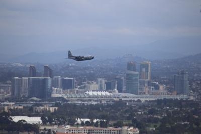
The squadron, also known as the Hurricane Hunters, conducted their first Atmospheric River mission Feb. 1 flying two WC-130J Hercules aircraft out of Naval Air Station North Island, San Diego. The Hurricane Hunters are working with the National Oceanic and Atmospheric Administration and the Scripps Institution of Oceanography at the University of California to conduct operational and research weather reconnaissance drops into these weather events.
"Atmospheric Rivers are just what they sound like, a river of moisture in the atmosphere," said Maj. Jeremy Dehart, 53rd WRS aerial reconnaissance weather officer. "During these events, moisture can be transported from the tropical areas and they normally occur during the winter time frame.”
These rivers of moisture are important for flooding and water sheds along the West Coast, and these events can provide the areas of California, Oregon, Washington and Alaska about half of their annual water supply, in just a few months.
This phenomenon is not as well understood as other weather events, so doing reconnaissance research missions are critical for analysis and to help create better forecast models. This is the third year for the Air Force Reserve 53rd WRS to participate in this type of mission.
“The data gathered during these research flights is sent directly via data assimilation to global numerical weather prediction models, and indirectly for forecast improvement,” said Maj. Ryan Rickert, 53rd WRS aerial reconnaissance weather officer, who served as the mission director. “This will give a better understanding of the physical processes at work in these storms, which can lead to better representation of these processes in models, and thus better forecasts at all relevant space and time scales.”
While flying in tropical cyclones, these Reserve Citizen Airmen fly between 500 to 10,000 feet above sea, with 500 feet being called an investigation mission, to provide weather data of sea level pressure, flight level and surface winds, temperature and moisture to the National Hurricane Center, where it is used to predict the intensity and path of the storm.
"While we release numerous dropsondes in tropical systems, the Atmospheric Rivers missions are dropsonde intensive, with the loadmasters dropping more than 30 dropsondes per mission. We fly a track across these rivers and the data that we gather is used to help improve the Global Forecast System models," said Dehart. "Simultaneously, the data gathered is studied and is being used by the Scripps Institution of Oceanography to compare how the models performed with and without the reconnaissance data."
During the Atmospheric River missions, the 53rd WRS Hurricane Hunters fly through these moisture bands between 25,000 to 30,000 feet. While the weather data sent is the same data, the Scripps Institution of Oceanography is primarily looking for the moisture at the mid to lower levels of the atmosphere.
During the mission Feb. 1, the squadron flew eight and a half hours and released around 70 dropsondes between the two aircraft, said Maj. Kimberly Spusta, 53rd WRS weather reconnaissance officer.
“We didn’t see much on the radar, but we were releasing dropsondes about every 50 to 60 miles during our flight,” she said.
Rickert said that ultimately the public benefits from the data collected because it will help provide a better lead time for impactful events, a better understanding of where these events will make landfall, how intense it will be and how long it will last. All of the things that have a big impact on the ground.
(Image provided with USAF news release)
 ANN's Daily Aero-Linx (05.06.25)

