FAA Successfully Completes Final ADS-B Milestone | Aero-News Network
Aero-News Network
RSS icon RSS feed
podcast icon MP3 podcast
Subscribe Aero-News e-mail Newsletter Subscribe

Airborne Unlimited -- Most Recent Daily Episodes

Episode Date

Airborne-Monday

Airborne-Tuesday

Airborne-Wednesday Airborne-Thursday

Airborne-Friday

Airborne On YouTube

Airborne-Unlimited-05.05.25

Airborne-NextGen-05.06.25

AirborneUnlimited-05.07.25

Airborne-Unlimited-05.01.25

AirborneUnlimited-05.02.25

Wed, Oct 09, 2019

FAA Successfully Completes Final ADS-B Milestone

Last Of 155 Airports To Receive ADS-B Went Operational Last Month

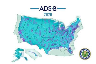
The FAA completed its final implementation milestone with Automatic Dependent Surveillance – Broadcast (ADS-B), the state-of-the-art surveillance system that enables air traffic controllers to track aircraft with greater accuracy and reliability.

The last two of the 155 airports to receive ADS-B, Akron-Canton Airport and Mansfield Lahm Regional Airport, both in Ohio, became operational last month.

This brings the operational rollout of ADS-B baseline services to a successful conclusion, on schedule and within budget, well in advance of Jan. 1, 2020, the date by which aircraft flying in certain, controlled airspace must be equipped with the technology.

ADS-B is now operational at air traffic control facilities across the country. These include airports, Terminal Radar Approach Control Facilities, which handle busy airspace around airports, and en route facilities, which handle high altitude traffic. All are using ADS-B as the preferred source of surveillance, which provides improved situation awareness to both pilots and controllers, among many other benefits and improvements.

ADS-B also enables more accurate tracking of airplanes and airport vehicles on runways and taxiways, increasing safety and efficiency. The new system significantly improves surveillance capability in areas with geographic challenges, like mountains or over water. Airplanes equipped with ADS-B In, which is not mandated, give pilots information through cockpit displays about location in relation to other aircraft, bad weather and terrain, and temporary flight restrictions.

(Image provided with FAA news release)

FMI: www.faa.gov

Advertisement

More News

ANN's Daily Aero-Linx (05.06.25)

Aero Linx: International Federation of Airworthiness (IFA) We aim to be the most internationally respected independent authority on the subject of Airworthiness. IFA uniquely combi>[...]

ANN's Daily Aero-Term (05.06.25): Ultrahigh Frequency (UHF)

Ultrahigh Frequency (UHF) The frequency band between 300 and 3,000 MHz. The bank of radio frequencies used for military air/ground voice communications. In some instances this may >[...]

ANN FAQ: Q&A 101

A Few Questions AND Answers To Help You Get MORE Out of ANN! 1) I forgot my password. How do I find it? 1) Easy... click here and give us your e-mail address--we'll send it to you >[...]

Classic Aero-TV: Virtual Reality Painting--PPG Leverages Technology for Training

From 2019 (YouTube Edition): Learning To Paint Without Getting Any On Your Hands PPG's Aerospace Coatings Academy is a tool designed to teach everything one needs to know about all>[...]

Airborne 05.02.25: Joby Crewed Milestone, Diamond Club, Canadian Pilot Insurance

Also: Sustainable Aircraft Test Put Aside, More Falcon 9 Ops, Wyoming ANG Rescue, Oreo Cookie Into Orbit Joby Aviation has reason to celebrate, recently completing its first full t>[...]

blog comments powered by Disqus


Advertisement

Advertisement

Podcasts

Advertisement

© 2007 - 2025 Web Development & Design by Pauli Systems, LC