Picture This: Pilots Use Webcam To Check En Route Weather | Aero-News Network
Aero-News Network
RSS icon RSS feed
podcast icon MP3 podcast
Subscribe Aero-News e-mail Newsletter Subscribe

Airborne Unlimited -- Most Recent Daily Episodes

Episode Date

Airborne-Monday

Airborne-Tuesday

Airborne-Wednesday Airborne-Thursday

Airborne-Friday

Airborne On YouTube

Airborne-Unlimited-11.10.25

AirborneNextGen-
11.11.25

Airborne-Unlimited-11.12.25

Airborne-Unlimited-11.06.25

AirborneUnlimited-11.07.25

LIVE MOSAIC Town Hall (Archived): www.airborne-live.net

Tue, Feb 15, 2005

Picture This: Pilots Use Webcam To Check En Route Weather

"It's Like Looking Out Your Window"

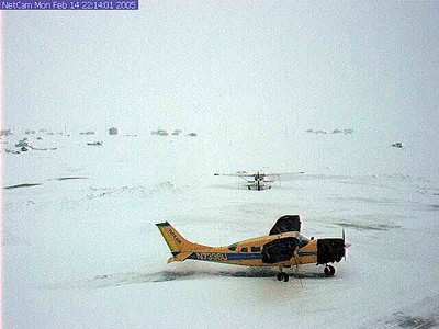
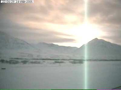
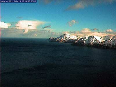
In Alaska, where the difference between the sky and the mountain is often less than the width of a single-engine aircraft, seeing is believing. That's why a lot of pilots in the Great White North are starting to swear by a new FAA program that literally lets them eyeball crucial mountain passes along their routes.

"It's like looking out of your window instead of studying data," said Mike Stedman, director of operations at Wings of Alaska. "We don't need to go out and burn the fuel and find out that you cannot land." Stedman was quoted by the Juneau Empire.

In fact, the service is rapidly becoming popular among other pilots as well. The Empire reports the National Weather Service, Coast Guard, and Alaska State Troopers all use the site to make their fly/no-fly decisions. Overall, the site received 3.3 million hits last year alone.

The FAA plans to install 165 camera sites by 2010.

"What pilots most appreciate is a holistic view of the weather that is not offered by automated weather systems and is otherwise only available at those sites manned by weather observers," said Susan Gardner, manager of the Alaska Weather Camera program. She told the Empire that, along with her staff, she's been traveling across the state talking with pilots, getting input on exactly where these cameras should be placed.

Remote viewing technology is by no means a new development in Alaska. In fact, the Coast Guard and the FAA together installed a camera system in Valdez to keep an eye on the Alaska oil pipeline terminus.

"They put that camera in because of all the air traffic coming in to bring the supplies and equipment to begin the pipeline," Gardner told the Juneau paper. "The visibility was so poor or the weather was deteriorating. The camera provided them with valuable information on whether to come in or not."

For the past eight years, the FAA's Alaska Regional Office has been working to develop video monitoring system. But that program, in spite of its success, languished with little Congressional attention, until it got a $5 million federal grant last year. With that money, Gardner says she'll refurbish existing cameras, replace analog units with digital cameras and continue to improve the system.

FMI: http://akweathercams.faa.gov

Advertisement

More News

ANN FAQ: Contributing To Aero-TV

How To Get A Story On Aero-TV News/Feature Programming How do I submit a story idea or lead to Aero-TV? If you would like to submit a story idea or lead, please contact Jim Campbel>[...]

Classic Aero-TV: Bob Hoover At Airventure -- Flight Test and Military Service

From 2011 (YouTube Edition): Aviation's Greatest Living Legend Talks About His Life In Aviation (Part 5, Final) ANN is pleased to offer you yet another snippet from the public conv>[...]

Aero-News: Quote of the Day (11.12.25)

“All Air Traffic Controllers must get back to work, NOW!!! Anyone who doesn’t will be substantially ‘docked. For those Air Traffic Controllers who were GREAT PATR>[...]

ANN's Daily Aero-Linx (11.12.25)

Aero Linx: American Navion Society Welcome to the American Navion Society. Your society is here to support the Navion community. We are your source of technical and operating infor>[...]

ANN's Daily Aero-Term (11.12.25): Glideslope Intercept Altitude

Glideslope Intercept Altitude The published minimum altitude to intercept the glideslope in the intermediate segment of an instrument approach. Government charts use the lightning >[...]

blog comments powered by Disqus


Advertisement

Advertisement

Podcasts

Advertisement

© 2007 - 2025 Web Development & Design by Pauli Systems, LC