Mon, Mar 05, 2018
Will Take Place at Reno-Stead Airport
A demonstration of NASA's NASA's UAS Traffic Management Technologies has been scheduled for March 8 at Reno-Stead airport in Nevada.
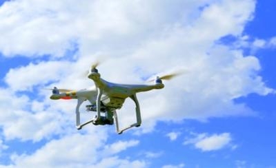
The flight demonstration, called UTM Technology Capability Level 3 (TCL3) will focus on flying small and large, remotely-operated aircraft, or drones in various NASA communication, navigation, and surveillance (CNS) and drone detection scenarios. For the first time, Nevada is unveiling an innovative Unmanned Traffic Management Drone Detection capability with participation of the top global drone detection companies. Drone detection is major concern across the UAS Industry and Nevada is leading the way to advance this technology in the Public Safety category. Nevada is doing this through an innovative airspace management system that sets Nevada apart from other states. Nevada is also demonstrating long-range communications between Reno and Las Vegas during this demonstration, which is important for NASA beyond visual line of sight operations and future Nevada operations. These new Nevada capabilities are routed through the Switch Fiber Optic SUPERLOOP – Nevada has the first FAA-designated UAS
Test Site to advance such capability in the U.S.
It is envisioned that UTM will have a mechanism to allow for basic services such as flight planning, flight monitoring, hazardous weather and wind avoidance and other potential services. Most of these services will be provided by a number of commercial UAS Service Suppliers (USS) rather than by a single system. These USS's then support missions by UAS operators.
The flight campaign, which is to run March 5 to March 9 at the Nevada FAA- designated UAS Test Site at the Reno-Stead Airport will be the third iteration of UTM testing. The test sites are partnering with government, industry, and academia to complete the flight tests. This second phase will demonstrate, evaluate, and refine functional designs and technology prototypes that will advance airspace traffic management for NASA and the highly competitive DOT / FAA UAS Integration Pilot Program set to be awarded in April 2018.
The public demonstration will take place Thursday, March 8, 8:30 a.m. – 11:00 a.m. PST
(Source: Nevada Institute for Autonomous Systems (NIAS) release. Image from file)
More News
Light Gun A handheld directional light signaling device which emits a brilliant narrow beam of white, green, or red light as selected by the tower controller. The color and type of>[...]
“We have performed extensive ground testing by comparing warm up times, full power tethered pulls, and overall temperatures in 100 degree environments against other aircraft >[...]
While Taxiing To Parking The Right Landing Gear Leg Collapsed, Resulting In Substantial Damage Analysis: The pilot made a normal approach with full flaps and landed on the runway. >[...]
From 2014 (YouTube Edition): Exotic Rebuild Reveals Aerial Work Of Art During EAA AirVenture 2014, ANN's Michael Maya Charles took the time to get a history lesson about a great ai>[...]
Also: Project Talon, McFarlane Acquisition, Sky-Tec Service, JPL Earth Helo Tests Bombardier has earned a round of applause from the business aviation community, celebrating the fo>[...]
 ANN's Daily Aero-Term (12.13.25): Light Gun

