ERAU Alumni Employ Drones for Post-Hurricane Assessment | Aero-News Network
Aero-News Network
RSS icon RSS feed
podcast icon MP3 podcast
Subscribe Aero-News e-mail Newsletter Subscribe

Airborne Unlimited -- Most Recent Daily Episodes

Episode Date

Airborne-Monday

Airborne-Tuesday

Airborne-Wednesday Airborne-Thursday

Airborne-Friday

Airborne On YouTube

Airborne-Unlimited-04.28.25

Airborne-NextGen-04.29.25

AirborneUnlimited-04.30.25

Airborne-Unlimited-05.01.25

AirborneUnlimited-05.02.25

Sun, Nov 03, 2024

ERAU Alumni Employ Drones for Post-Hurricane Assessment

Current and Former Students Use Sentaero 5 Drone to Map Damage

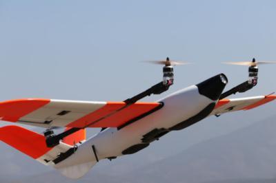
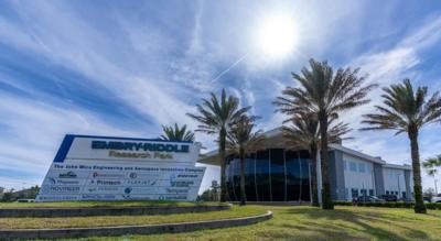
Censys Technologies, a start-up hosted on Embry?Riddle’s Daytona Beach Campus, is utilizing its Sentaero 5 drone to assess the area following recent Hurricane Helene. This data will be used to measure damage and plan future mitigation efforts.

“It was horrible to see the flooding and damage that was done,” commented Matthew Davis, a current Embry Riddle Uncrewed Aircraft Systems (UAS) student and a member of Censys’s storm damage assessment team. “It felt great to get out and be able to do something to help.”

Hurricane Helene made landfall on September 26 as a Category 4 storm, ripping through Florida’s Gulf Coast. After it passed, Censys executed a five-day mission to assess street and infrastructure damage, debris, and flooding.  This was conducted by four ERAU alumni across two UAS teams.

Censys was granted a Special Government Interest (SGI) certification by the FAA for the mission, allowing its teams to conduct operations beyond visual line of sight (BVLOS). This enabled them to complete tasks more efficiently and effectively.

“Providing post-storm mapping response for Hurricane Helene was a whirlwind of an experience,” explained Larry Leovan, head of government sales at Censys. “In total, we were able to capture 499 linear miles of roads, 20,507 images, 501GB worth of data in five days."

Senior ERAU UAS student James Deal was recently involved in a project that employed drones and Light Detection and Ranging (LiDAR) sensing to evaluate various stormwater solutions in Cape Canaveral, Florida. This was later used to build flood models that could potentially generate preventative infrastructure designs.

“UAS are essential in any flood mitigation toolbox as an invaluable resource to gather accurate models through LiDAR and photogrammetry,” stated Deal. “These models are necessary to accurately predict the impact of future weather and allow for simulation and iteration of flood mitigation strategies at a low cost.”

Censys was founded by Embry Riddle alumni. Its Sentaero 5 drone has a range 7.5 times greater than typical fixed wing drones and has been trusted with BVLOS approvals more than 45 times. The design features high-tech sensors, cameras, collision avoidance, and stall prevention for improved safety.

FMI: www.censystech.com

Advertisement

More News

ANN's Daily Aero-Linx (04.30.25)

Aero Linx: Aviators Code Initiative (ACI) Innovative tools advancing aviation safety and offering a vision of excellence for aviators. The ACI materials are for use by aviation pra>[...]

ANN FAQ: Turn On Post Notifications

Make Sure You NEVER Miss A New Story From Aero-News Network Do you ever feel like you never see posts from a certain person or page on Facebook or Instagram? Here’s how you c>[...]

Classic Aero-TV: Agile Aero’s Jeff Greason--Disruptive Aerospace Innovations

From 2016 (YouTube Edition): Who You Gonna Call When You Have a Rocket Engine that Needs a Spacecraft? While at EAA AirVenture 2016, ANN CEO and Editor-In-Chief, Jim Campbell, sat >[...]

Aero-News: Quote of the Day (04.30.25)

"In my opinion, if this isn't an excessive fine, I don't know what is... The odds are good that we're gonna be seeking review in the United States Supreme Court. So we gotta muster>[...]

ANN's Daily Aero-Term (04.30.25): Expedite

Expedite Used by ATC when prompt compliance is required to avoid the development of an imminent situation. Expedite climb/descent normally indicates to a pilot that the approximate>[...]

blog comments powered by Disqus


Advertisement

Advertisement

Podcasts

Advertisement

© 2007 - 2025 Web Development & Design by Pauli Systems, LC