Seattle Avionics Boasts All-New Real-Time Charting Engine, Plus
Geo-Referenced Scanned Sectionals and IFR Charts
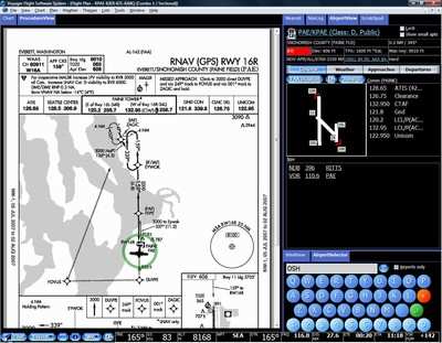
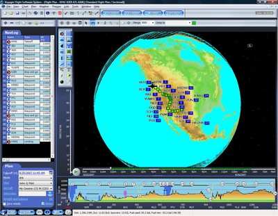
Seattle Avionics will be demonstrating their latest version of
Voyager Flight Software System, Version 4.0, at the 2007 AOPA Expo.
V4.0 features a completely re-written charting engine based on the
same DirectX technology that Google Earth and Microsoft Flight
Simulator use. Voyager's all-new charting engine is effectively
real-time, capable of updating the screen more than 50 times a
second, depending on hardware. This allows smooth, real-time zooms
and pans - the first general aviation software offering this
state-of-the-art technology.
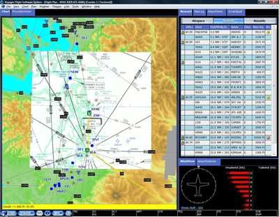
Significantly, Voyager 4.0 can also display any combination of
digital vector data and geo-referenced scanned Sectionals and IFR
charts. This means that pilots can plan and fly using
geo-referenced Sectionals or IFR enroute charts with overlaid
weather, TFRs and aircraft position. Voyager 4.0 seamlessly merges
all Sectionals and IFR charts so pilots need not select particular
charts to display; they simply pick the type of chart to display
and Voyager does the rest.
"This version of Voyager has been in the works for nearly two
years and we're ecstatic to be demonstrating it today," said Steve
Podradchik, CEO of Seattle Avionics Software.
"Over the years, pilots have said they loved Voyager's features
but wanted it to be faster. We listened and rewrote the charting
engine from the ground up, the difference being like night and day.
Importantly, rather than write a fast but strictly 2D charting
engine, we opted to spend the time and resources to use the very
latest high-speed 3D graphics technology to lay the foundation for
future versions of Voyager."
Voyager 4.0 also incorporates a new color scheme that works well
in both daylight and night flights and the more than 50
enhancements included in the recently released Voyager 3.6.
New features include:
- Current AvGas and Jet-A fuel prices integrated into the
autorouter so that it automatically minimizes total fuel costs
based on prices updated daily. Voyager also displays fuel prices on
charts and in many places while using GlassView.
- Export flight plans to Google Earth for virtual, 3D
fly-throughs over actual three-dimensional satellite photos.
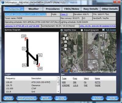
- Integrated Google Maps lets Voyager show actual satellite
images of each airport that can be zoomed in and out.
- Memory Card Synch feature makes it easy to put Voyager data on
a memory card to transfer to another computer.
Other recently added features include Voyager's exclusive Web
Synch that performs "one-click" data synchronization among multiple
computers for all pilot-specific information such as flight plans,
aircraft and pilots profiles through the Internet and the ability
to print flight plans to PDF files.
Pilots can get a personal demonstration of new Voyager 4.0 at
AOPA Expo, Booth #214. The company always offers self-running
demos, free Live Demo Webinars, and a free version of Voyager
called FreeFlight.
 Klyde Morris (05.02.25)