FAA Provides Information For Drone Operators Regarding Hurricane Florence | Aero-News Network
Aero-News Network
RSS icon RSS feed
podcast icon MP3 podcast
Subscribe Aero-News e-mail Newsletter Subscribe

Airborne Unlimited -- Most Recent Daily Episodes

Episode Date

Airborne-Monday

Airborne-Tuesday

Airborne-Wednesday Airborne-Thursday

Airborne-Friday

Airborne On YouTube

Airborne-Unlimited-10.27.25

AirborneNextGen-
10.28.25

Airborne-Unlimited-10.29.25

Airborne-Unlimited-10.30.25

AirborneUnlimited-10.17.25

Fri, Sep 14, 2018

FAA Provides Information For Drone Operators Regarding Hurricane Florence

Warns That Heavy Fines Can Be Imposed If Drones Interfere With Emergency Operations

The FAA is warning drone owners and operators they may face significant fines if they interfere with emergency response operations in the areas affected by Hurricane Florence.

Many aircraft that are conducting life-saving missions and other critical response and recovery efforts are likely to be flying at low altitudes over areas affected by the storm. Flying a drone without authorization in or near the disaster area may unintentionally disrupt rescue operations and violate federal, state, or local laws and ordinances, even if a Temporary Flight Restriction (TFR) is not in place. Allow first responders to save lives and property without interference.

Government agencies with an FAA Certificate of Authorization (COA) or flying under Part 107, as well as private sector Part 107 drone operators who want to support response and recovery operations, are strongly encouraged to coordinate their activities with the local incident commander responsible for the area in which they want to operate.

If drone operators need to fly in controlled airspace or a disaster TFR to support the response and recovery, operators must contact the FAA’s System Operations Support Center (SOSC) by emailing 9-ATOR-HQ-SOSC@faa.gov the information they need to authorize access to the airspace. Coordination with the SOSC may also include a requirement that a drone operator obtain support from the appropriate incident commander.

Here’s the information the FAA may require:

  • the unmanned aircraft type
  • a PDF copy of a current FAA COA
  • the pilot’s Part 107 certificate number
  • details about the proposed flight (date, time, location, altitude, direction and distance to the nearest airport, and latitude/longitude)
  • nature of the event (fire, law enforcement, local/national disaster, missing person) and the pilot’s qualification information.

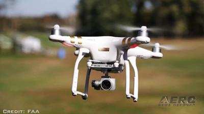
(Source: FAA news release. Image from file)

FMI: www.faa.gov

Advertisement

More News

ANN's Daily Aero-Term (10.31.25): Minimum Sector Altitude [ICAO]

Minimum Sector Altitude The lowest altitude which may be used under emergency conditions which will provide a minimum clearance of 300 m (1,000 feet) above all obstacles located in>[...]

ANN's Daily Aero-Linx (10.31.25)

Aero Linx: African Civil Aviation Commission (AFCAC) At AFCAC, our Safety Strategic Objective is to enhance Aviation Safety and the efficiency of Air Navigation Services in Africa.>[...]

NTSB Final Report: Airbus A321-271N (A1); Cessna 172N (A2)

The Local Controller’s Poor Judgment In Prioritization Of Their Ground Traffic Ahead Of Their Airborne Traffic Analysis: Hawaiian Airlines flight 70 (HAL70), N2165HA, an Airb>[...]

ANN FAQ: Follow Us On Instagram!

Get The Latest in Aviation News NOW on Instagram Are you on Instagram yet? It's been around for a few years, quietly picking up traction mostly thanks to everybody's new obsession >[...]

Airborne 10.30.25: Earhart Search, SpaceX Speed Limit, Welcome Back, Xyla!

Also: Beech M-346N, Metro Gains H160 EMS STC, New Bell Boss, Affordable Flying Expo Tickets NOW On Sale! Purdue University’s Research Foundation and the Archaeological Legacy>[...]

blog comments powered by Disqus


Advertisement

Advertisement

Podcasts

Advertisement

© 2007 - 2025 Web Development & Design by Pauli Systems, LC