Aero-TV: The Portable AV8OR Ace - Raising the Bar on Capabilities | Aero-News Network
Aero-News Network
RSS icon RSS feed
podcast icon MP3 podcast
Subscribe Aero-News e-mail Newsletter Subscribe

Airborne Unlimited -- Most Recent Daily Episodes

Episode Date

Airborne-Monday

Airborne-Tuesday

Airborne-Wednesday Airborne-Thursday

Airborne-Friday

Airborne On YouTube

Airborne-Unlimited-07.07.25

Airborne-NextGen-07.08.25

AirborneUnlimited-07.09.25

Airborne-FlightTraining-07.10.25

AirborneUnlimited-07.11.25

Tue, Dec 01, 2009

Aero-TV: The Portable AV8OR Ace - Raising the Bar on Capabilities

Honeywell’s AV8OR ACE Enables Increased Paperless Cockpit Capabilities

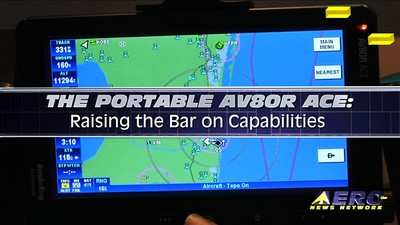
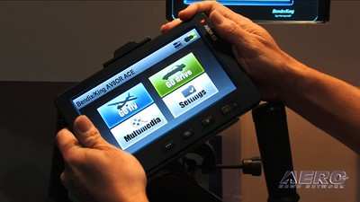
At EAA AirVenture 2009, Honeywell introduced their next evolution in avionics products, the Bendix/King AV8OR ACE, at an introductory price of only $1999. Offering a seven-inch display, the AV8OR ACE includes a sunlight-readable touchscreen interface for easy viewing and usage; the “Touch and See” capability allows users to simply tap on screen objects, such as airports, VORs, and airspace boundaries, to quickly access further information. Customers can use aviation navigation in either portrait or landscape modes.

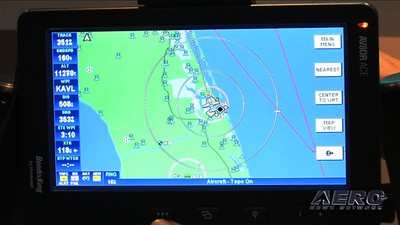
The lightweight design also features FAA IFR geo-referenced charts, eliminating the need to carry paper charts in travel. The AV8OR ACE dramatically increases situational awareness by providing aircraft location display directly on High and Low en route charts, approach plates, and airport taxiway diagrams. Customers can obtain digital charts and approach charts from Bendix-King's vendor.

The AV8OR ACE includes a WAAS GPS system, automotive navigation, regional databases, and flight guide airport services data including fuel pricing, FBO information, and local facilities guidance.  The unit’s multimedia functionality and Bluetooth capability allows for data linkage with Bluetooth-enabled phones, alternative GPS receiver, and XM weather receiver. 

The weather interface supports WxWorx, allowing the AV8OR ACE to display real-time weather information overlaid in detail on a moving map, including graphical METARs, AIRMETs, SIGMETS, and PIREPs.

FMI: https://www.bendixking.com/AV8OR/ACE/index.html, https://www.bendixking.com/AV8OR/, http://www.aero-tv.net, http://www.youtube.com/aerotvnetwork, http://twitter.com/AeroNews

Advertisement

More News

Classic Aero-TV: Up Close And Personal - The Aeroshell Aerobatic Team at Oshkosh

From 2014 (YouTube Version): One Of The Airshow World's Pre-Eminent Formation Teams Chats About The State Of The Industry At EAA AirVenture 2014, ANN News Editor Tom Patton gets th>[...]

ANN's Daily Aero-Term (07.13.25): Tactical Air Navigation (TACAN)

Tactical Air Navigation (TACAN) An ultra-high frequency electronic rho-theta air navigation aid which provides suitably equipped aircraft a continuous indication of bearing and dis>[...]

ANN's Daily Aero-Linx (07.13.25)

Aero Linx: Doobert Hi, we're Chris & Rachael Roy, founders and owners of Doobert. Chris is a technology guy in his “day” job and used his experience to create Doobe>[...]

NTSB Prelim: Pitts S2

The Airplane Was Spinning In A Nose-Down Attitude Before It Impacted Terrain On June 20, 2025, at 0900 eastern daylight time, a Pitts Aerobatics S-2B, N79AV, was destroyed when it >[...]

Airborne 07.09.25: B-17 Sentimental Journey, Airport Scandal, NORAD Intercepts

Also: United Elite Sues, Newark ATC Transitions, Discovery Moves?, Textron @ KOSH The Commemorative Air Force Airbase Arizona is taking its “Flying Legends of Victory Tour&rd>[...]

blog comments powered by Disqus


Advertisement

Advertisement

Podcasts

Advertisement

© 2007 - 2025 Web Development & Design by Pauli Systems, LC