Goal Is To Identify Rapidly Intensifying Storms
 NASA is funding the development of a prototype system to
provide aircraft with updates about severe storms and turbulence as
they fly across remote ocean regions.
NASA is funding the development of a prototype system to
provide aircraft with updates about severe storms and turbulence as
they fly across remote ocean regions.
Scientists at the National Center for Atmospheric Research
(NCAR) in Boulder, Colo., in partnership with colleagues at the
University of Wisconsin, are developing a system that combines
satellite data and computer weather models with cutting-edge
artificial intelligence techniques. The goal is to identify and
predict rapidly evolving storms and other potential areas of
turbulence.
"Turbulence is the leading cause of injuries in commercial
aviation," said John Haynes, program manager in the Earth Science
Division's Applied Sciences Program at NASA Headquarters in
Washington. "This new work to detect the likelihood of turbulence
associated with oceanic storms using key space-based indicators is
of crucial importance to pilots."
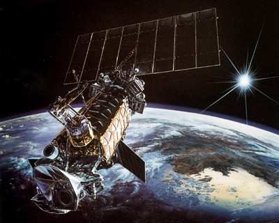
The system is designed to help guide pilots away from intense
weather. A variety of NASA spacecraft observations are being used
in the project, including data from NASA's Terra, Aqua, Tropical
Rainfall Measuring Mission, CloudSat and CALIPSO satellites.
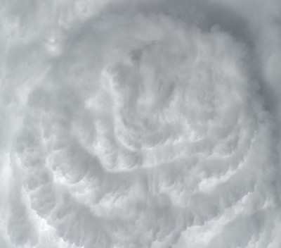
The prototype system will identify areas of turbulence in clear
regions of the atmosphere as well as within storms. It is on track
for testing next year. Pilots on selected transoceanic routes will
receive real-time turbulence updates and provide feedback. When the
system is finalized, it will provide pilots and ground-based
controllers with text-based maps and graphical displays showing
regions of likely turbulence and storms.
"Pilots currently have little weather information as they fly
over remote stretches of the ocean, which is where some of the
worst turbulence occurs," said scientist John Williams, one of the
project leads at NCAR. "Providing pilots with at least an
approximate picture of developing storms could help guide them
safely around areas of potentially severe turbulence."
NCAR currently provides real-time maps of turbulence at various
altitudes over the continental United States. Williams and his
colleagues are building on this expertise to identify turbulence
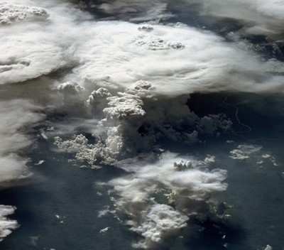
over oceans. The team has created global maps of clear air
turbulence based on global computer weather models that include
winds and other instabilities in the atmosphere. Drawing on
satellite images of storms, the scientists also have created global
views of the tops of storm clouds. Higher cloud tops often are
associated with more intense storms, although not necessarily with
turbulence.
The next step is to pinpoint areas of possible turbulence within
and around intense storms. The team will study correlations between
storms and turbulence over the continental United States, where
weather is closely observed, and then infer patterns of turbulence
for storms over oceans.
In addition to providing aircraft and ground controllers with
up-to-the-minute maps of turbulence, the NCAR team is turning to an
artificial intelligence technique, known as "random forests," to
provide short-term forecasts.
Random forests, which have proven useful for forecasting
thunderstorms over land, consist of many decision trees that each
cast a yes-or-no "vote" on crucial elements of the storm at future
points in time and space. This enables scientists to forecast the
movement and strength of the storm during the next few hours.
"Our goal is to give pilots a regularly updated picture of the
likely storms ahead as they fly over the ocean, so they can take
action to minimize turbulence and keep their aircraft out of
danger," explained NCAR scientist Cathy Kessinger, a project team
member.
The NCAR project is funded by NASA's Applied Sciences Program,
which seeks to translate NASA's investment in Earth observations
into applications that address real problems. The program and its
partners are working to bridge the gap between research results and
operational aviation weather products in such areas as in-flight
icing, convective weather, turbulence, volcanic ash and space
weather.
 Aero-FAQ: Dave Juwel's Aviation Marketing Stories -- ITBOA BNITBOB

