Sun, Jun 14, 2009
Third US Airport To Install Runway Status Lights
Technology that alerts pilots to potential runway safety hazards
is now operating at Los Angeles International Airport thanks to a
partnership between the Federal Aviation Administration and the
City of Los Angeles.
The system, called Runway Status Lights, uses a series of red
lights embedded in the pavement to warn pilots if it's unsafe to
enter or cross a runway, or to take off. Los Angeles World Airports
paid for the $7 million system; the FAA installed the system and
will maintain it. "Runway Status Lights are a critical safety
enhancement for LAX," said Wes Timmons, the FAA's director of
runway safety. "This system has proved that it is highly effective
in preventing potentially dangerous runway incidents from
occurring."
LAX is the third U.S. airport to get Runway Status Lights
following several years of successful tests at Dallas-Fort Worth
and San Diego. It's the first airport to have the lights installed
on multiple runways. "With the installation of Runway Status
Lights, LAX has established itself ahead of the curve when it comes
to passenger safety," said Los Angeles Mayor Antonio Villaraigosa.
"Through partnership with the FAA, Los Angeles will continue to
ensure the utmost safety on the LAX airfield."
Runway Status Lights are connected to LAX's ground radar system.
The lights turn red if the ground radar detects a potential
conflict between two aircraft or an aircraft and a vehicle. They're
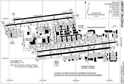
installed on eight LAX taxiways and one runway. Clearance to cross
or enter a runway must be given by air traffic control. When the
lights go off, the pilot or vehicle driver must verify the
clearance before proceeding.
Runway Status Lights are the latest safety enhancement at LAX.
The FAA also recently installed the most technologically advanced
ground radar system, known as Airport Surface Detection
Equipment-X, or ASDE-X, in the air traffic control tower. ASDE-X
collects data from more sources than LAX's previous ground radar
system, and provides air traffic controllers with color map
displays showing the location of all aircraft and vehicles on the
runways and taxiways.
More News
About 2132 And At 11,800 Ft MSL, The Airplane Began A Rapid Right Spiraling Descent On August 18, 2025, about 2133 central daylight time, a Lancair NLA-275-FR-C airplane, N345LA, w>[...]
Aero Linx: The Collings Foundation The Collings Foundation is a non-profit, Educational Foundation (501(c)3), founded in 1979. The purpose of the Foundation is to preserve and exhi>[...]
"This first FAA certification enables us to address the pilot shortage crisis with modern training solutions. Flight schools need alternatives to aging fleets with 40-year-old desi>[...]
North Atlantic High Level Airspace (NAT HLA) That volume of airspace (as defined in ICAO Document 7030) between FL 285 and FL 420 within the Oceanic Control Areas of Bodo Oceanic, >[...]
“HITRON embodies the Coast Guard’s spirit of innovation and adaptability. From its humble beginnings as a prototype program, it has evolved into a vital force in our co>[...]
 NTSB Prelim: Lancair NLA-275-FR-C