Thu, Aug 17, 2017
Designed Primarily For Use By Public Safety Agencies
CompassDrone is set to unveil a comprehensive drone-based mapping program designed specifically for Public Safety applications. The Complete Incident Response Recovery Unmanned Aerial System (CIRRUAS) program is designed primarily for Accident Reconstruction and Crime Scene Mapping, but is also applicable to Search & Rescue and Reconnaissance missions.
"CIRRUAS was designed by law enforcement for law enforcement to meet their unique mapping and data collection needs," said CompassDrone Vice President Hayden Howard. "The result is a complete drone program comprising all the hardware, software and training they need to deploy drones in their daily operations."
CompassDrone will showcase and demonstrate the CIRRUAS solution at the 2017 APCO Conference & Exhibition being held through August 16 in Denver.
"We designed CIRRUAS to make data collection safer, faster and more accurate for public safety officers," said Howard. "The program is an affordable, all-inclusive solution for mapping with unmanned aerial systems."
The CIRRUAS package contains everything needed for public safety personnel to quickly and accurately map an accident or crime scene for 3D reconstruction or evidence preservation purposes. Different CIRRUAS packages are offered, but each contains multiple DJI drones -- the best-selling unmanned aerial systems in the world -- software, and Part 107 commercial flight training.
"The DJI drones selected for this package capture imagery of sufficient quality for the 3D photogrammetric mapping required for accident reconstruction and crime scene visualization," said Howard. "Every CIRRUAS package is backed up with ongoing technical and applications support by CompassDrone personnel."
The Elbert County, Colorado, Sheriff's Department is among the first to participate in the program. The department's Lt. Patrick Cillo said, "It's an extremely comprehensive program."
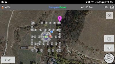
(Source: CompassDrone news release. Screenshot Courtesy CompassDrone website)
More News
Pilot Also Reported That Due To A Fuel Leak, The Auxiliary Fuel Tanks Were Not Used On June 4, 2025, at 13:41 eastern daylight time, a Piper PA-23, N2109P, was substantially damage>[...]
Have A Story That NEEDS To Be Featured On Aero-News? Here’s How To Submit A Story To Our Team Some of the greatest new stories ANN has ever covered have been submitted by our>[...]
From 2023 (YouTube Edition): Reflections on War’s Collective Lessons and Cyclical Nature The exigencies of war ought be colorblind. Inane social-constructs the likes of racis>[...]
Aero Linx: Colorado Pilots Association (CPA) Colorado Pilots Association was incorporated as a Colorado Nonprofit Corporation in 1972. It is a statewide organization with over 700 >[...]
High Speed Taxiway A long radius taxiway designed and provided with lighting or marking to define the path of aircraft, traveling at high speed (up to 60 knots), from the runway ce>[...]
 NTSB Prelim: Piper PA-23

