QinetiQ Completes First Flight Of UK Agricultural Monitoring UAV | Aero-News Network
Aero-News Network
RSS icon RSS feed
podcast icon MP3 podcast
Subscribe Aero-News e-mail Newsletter Subscribe

Airborne Unlimited -- Most Recent Daily Episodes

Episode Date

Airborne-Monday

Airborne-Tuesday

Airborne-Wednesday Airborne-Thursday

Airborne-Friday

Airborne On YouTube

Airborne-Unlimited-05.13.24

Airborne-NextGen-05.07.24

Airborne-Unlimited-05.08.24 Airborne-FlightTraining-05.09.24

Airborne-Unlimited-05.10.24

Fri, Aug 08, 2008

QinetiQ Completes First Flight Of UK Agricultural Monitoring UAV

U-MAP Program Aims To Monitor Land Suitability

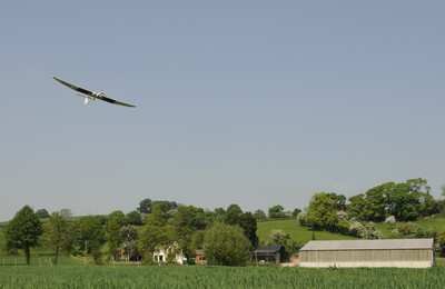
QinetiQ, working in partnership with Aberystwyth University's new biosciences centre IBERS, has successfully completed the UK's first flight of an autonomous unmanned aerial vehicle (UAV) for agricultural monitoring.

The flight was the culmination of phase one of the pioneering U-MAP program, a project supported by the Welsh Assembly Government. U-MAP (UAVs for Managing Agricultural Practice) has demonstrated the feasibility of using a UAV to deliver high resolution images to the agricultural, forestry and environmental monitoring sectors.

Farmers and foresters increasingly need accurate and timely information on the state of the land they occupy. For example by mapping the fertilizer requirements of arable crops, farmers can ensure they only apply the precise amount of fertilizer required, saving them money and preventing the pollution that occurs when nitrate fertilizers are over-applied.

The QinetiQ team acted as systems integrator for the specially adapted UAV platform and flew a total of more than 15 flights during the "work-up" phase and in support of data gathering. The UAV captured specialized video images that were used to create NDVI (normalised difference vegetation index) maps – sensitive indicators of the amount of vegetation present that can be used to determine fertilizer requirements.

"The UMAP project brings together emerging UAV technology with the growing need for farmers to fully understand the land they have under cultivation," commented Clive Richardson, Chief Operating Officer for QinetiQ's EMEA business. "With these recent flights we have successfully shown that UAVs are an affordable and flexible alternative to manned aircraft and satellites for the remote sensing of agricultural land."

FMI: www.qinetiq.com

Advertisement

More News

Airborne 05.10.24: Icon Auction, Drunk MedEvac Pilot, Bell ALFA

Also: SkyReach Parts Support, Piper Service Ctr, Airliner Near-Miss, Airshow London The Judge overseeing Icon's convoluted Chapter 11 process has approved $9 million in Chapter 11 >[...]

ANN's Daily Aero-Term (05.13.24): ILS PRM Approach

ILS PRM Approach An instrument landing system (ILS) approach conducted to parallel runways whose extended centerlines are separated by less than 4,300 feet and at least 3,000 feet >[...]

ANN's Daily Aero-Linx (05.13.24)

Aero Linx: FlyPups FlyPups transports dogs from desperate situations to fosters, no-kill shelters, and fur-ever homes. We deliver trained dogs to veterans for service and companion>[...]

Airborne-NextGen 05.07.24: AI-Piloted F-16, AgEagle, 1st 2 WorldView Sats

Also: Skydio Chief, Uncle Sam Sues, Dash 7 magniX, OR UAS Accelerator US Secretary of the Air Force Frank Kendall was given a turn around the patch in the 'X-62A Variable In-flight>[...]

Airborne 05.08.24: Denali Update, Dad-Daughter Gyro, Lake SAIB

Also: NBAA on FAA Reauth, DJI AG Drones, HI Insurance Bill Defeated, SPSA Airtankers The Beechcraft Denali continues moving forward towards certification, having received its FAA T>[...]

blog comments powered by Disqus


Advertisement

Advertisement

Podcasts

Advertisement

© 2007 - 2024 Web Development & Design by Pauli Systems, LC