CO TFR: 06.20.08 - 06.22.08 | Aero-News Network
Aero-News Network
RSS icon RSS feed
podcast icon MP3 podcast
Subscribe Aero-News e-mail Newsletter Subscribe

Airborne Unlimited -- Most Recent Daily Episodes

Episode Date

Airborne-Monday

Airborne-Tuesday

Airborne-Wednesday Airborne-Thursday

Airborne-Friday

Airborne On YouTube

Airborne-Unlimited-07.14.25

Airborne-NextGen-07.15.25

AirborneUnlimited-07.16.25

Airborne-FlightTraining-07.17.25

AirborneUnlimited-07.11.25

Wed, Jun 18, 2008

CO TFR: 06.20.08 - 06.22.08

NOTAM Number: FDC 8/2864
Issue Date: June 17, 2008 at 1410 UTC
Location: Avon, Colorado
Beginning Date and Time: June 20, 2008 at 0125 UTC
Ending Date and Time: June 22, 2008 at 1915 UTC
Reason for NOTAM: Temporary flight restrictions for VIP (Very Important Person) Movement
Type: VIP
Replaced NOTAM(s): N/A

Affected Area(s)

Area A
Airspace Definition:
 Center: On the SNOW VOR/DME (SXW) 069 degree radial at 3.5 nautical miles. (Latitude: 39º38'18"N, Longitude: 106º55'00"W)
 Radius: 3 nautical miles
 Altitude: From the surface up to but not including 3000 feet AGL
Effective Date(s):
 From June 20, 2008 at 0125 UTC (June 19, 2008 at 1925 MDT)
 To June 20, 2008 at 0215 UTC (June 19, 2008 at 2015 MDT)

Area B
Airspace Definition:
 Center: On the RED TABLE VOR/DME (DBL) 046 degree radial at 20 nautical miles. (Latitude: 39º36'58"N, Longitude: 106º31'41"W)
 Radius: 4 nautical miles
 Altitude: From the surface up to but not including 3000 feet AGL
Effective Date(s):
 From June 20, 2008 at 0210 UTC (June 19, 2008 at 2010 MDT)
 To June 22, 2008 at 1830 UTC (June 22, 2008 at 1230 MDT)

Area C
Airspace Definition:
 Center: On the SNOW VOR/DME (SXW) 069 degree radial at 3.5 nautical miles. (Latitude: 39º38'18"N, Longitude: 106º55'00"W)
 Radius: 3 nautical miles
 Altitude: From the surface up to but not including 3000 feet AGL
Effective Date(s):
 From June 22, 2008 at 1825 UTC (June 22, 2008 at 1225 MDT)
 To June 22, 2008 at 1915 UTC (June 22, 2008 at 1315 MDT)

Operating Restrictions and Requirements

No pilots may operate an aircraft in the areas covered by this NOTAM (except as described).

Unless otherwise authorized by ATC.

Other Information:

ARTCC: ZDV - Denver Center
Authority: Title 14 CFR section 91.141

FMI: www.tfr.faa.gov, Depicted TFR data may not be a complete listing. Pilots should not use the information on this website for flight planning purposes. For the latest information, call your local Flight Service Station at 1-800-WX-BRIEF.

Advertisement

More News

ANN's Daily Aero-Term (07.15.25): Charted Visual Flight Procedure Approach

Charted Visual Flight Procedure Approach An approach conducted while operating on an instrument flight rules (IFR) flight plan which authorizes the pilot of an aircraft to proceed >[...]

Aero-News: Quote of the Day (07.15.25)

“When l became the Secretary of Defense, I committed to rebuild our military to match threats to capabilities. Drones are the biggest battlefield innovation in a generation, >[...]

ANN's Daily Aero-Linx (07.15.25)

Aero Linx: Stearman Restorers Association Welcome to the Stearman Restorers Association. The Stearman Restorers Association is an independent “Not for Profit” 501C-3 Co>[...]

NTSB Final Report: Kjelsrud Gary Kitfox

Airplane Exhibited A Partial Loss Of Engine Power When It Was About Halfway Down The Runway Analysis: The pilot of the experimental amateur-built airplane was departing from his pr>[...]

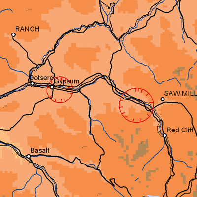
NTSB Prelim: Cessna A150L

The Flight Path Was Consistent With Low-Altitude Maneuvering On June 18, 2025, about 0922 mountain standard time, a Cessna A150L airplane, N6436F, was substantially damaged when it>[...]

blog comments powered by Disqus


Advertisement

Advertisement

Podcasts

Advertisement

© 2007 - 2025 Web Development & Design by Pauli Systems, LC