Drones A Valuable Tool In The Wake Of Alabama Tornadoes | Aero-News Network
Aero-News Network
RSS icon RSS feed
podcast icon MP3 podcast
Subscribe Aero-News e-mail Newsletter Subscribe

Airborne Unlimited -- Most Recent Daily Episodes

Episode Date

Airborne-Monday

Airborne-Tuesday

Airborne-Wednesday Airborne-Thursday

Airborne-Friday

Airborne On YouTube

Airborne-Unlimited-06.23.25

Airborne-NextGen-06.24.25

AirborneUnlimited-06.25.25

Airborne-AffordableFlyers-06.26.25

AirborneUnlimited-06.27.25

Sat, Mar 09, 2019

Drones A Valuable Tool In The Wake Of Alabama Tornadoes

Allows Aerial Views Of Areas Cut Off From Ground Transportation

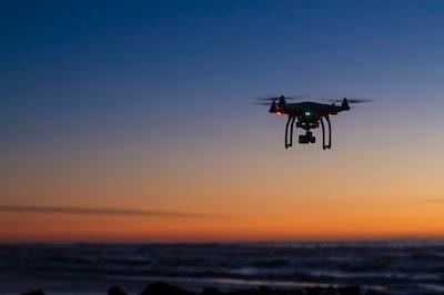
In the wake of the devastating tornadoes that ripped through rural Alabama Sunday, rescuers deployed drones into areas that were otherwise inaccessible to look for survivors and assess damage.

USA Today reports that Lee County, AL Sheriff Jay Jones said his department has been using drones for a "couple of years" but this is the first time they have been deployed for "extensive search and recovery. It gave us an overhead view of areas that we might’ve missed had we been at eye level on land," Sheriff Jones said.

Jones said that the small aircraft made searching for survivors much more efficient. Given the wide swath of damage caused by the storms, that was important.

In Lee County, Opelika, AL Fire Chief Byron Prather said that drones equipped with infrared sensors helped greatly in directing first responders to places where people needed to be rescued. "Ten years ago, it wasn't available," Prather said. That's technology helping us do our job better."

Chris Darden, who was a part of the team that helped test drones as a damage assessment tool when he led the National Weather Service Office in Huntsville, AL, was on the ground in hard-het Beauregard, AL following the storm. He said that the NWS was also planning to use drones to get a better handle on the storm's path and damage it caused. "Sometimes, it can take a tragedy to open your eyes to new tools you have available," he said.

(Image from file)

FMI: Source report 

Advertisement

More News

ANN's Daily Aero-Linx (06.29.25)

Aero Linx: Transport Canada We are a federal institution, leading the Transport Canada portfolio and working with our partners. Transport Canada is responsible for transportation p>[...]

ANN's Daily Aero-Term (06.29.25): Gross Navigation Error (GNE)

Gross Navigation Error (GNE) A lateral deviation from a cleared track, normally in excess of 25 Nautical Miles (NM). More stringent standards (for example, 10NM in some parts of th>[...]

Classic Aero-TV: Anticipating Futurespace - Blue Origin Visits Airventure 2017

From AirVenture 2017 (YouTube Edition): Flight-Proven Booster On Display At AirVenture… EAA AirVenture Oshkosh is known primarily as a celebration of experimental and amateu>[...]

NTSB Final Report: Cirrus SR22

Aircraft Parachute System (CAPS) Was Deployed About 293 Ft Above Ground Level, Which Was Too Low To Allow For Full Deployment Of The Parachute System Analysis: The day before the a>[...]

Airborne Affordable Flyers 06.26.25: PA18 Upgrades, ‘Delta Force’, Rhinebeck

Also: 48th Annual Air Race Classic, Hot Air Balloon Fire, FAA v Banning 100LL, Complete Remote Pilot The news Piper PA-18 Super Cub owners have been waiting for has finally arrived>[...]

blog comments powered by Disqus


Advertisement

Advertisement

Podcasts

Advertisement

© 2007 - 2025 Web Development & Design by Pauli Systems, LC