DJI Launches Public Beta Of New Geofencing System | Aero-News Network
Aero-News Network
RSS icon RSS feed
podcast icon MP3 podcast
Subscribe Aero-News e-mail Newsletter Subscribe

Airborne Unlimited -- Most Recent Daily Episodes

Episode Date

Airborne-Monday

Airborne-Tuesday

Airborne-Wednesday Airborne-Thursday

Airborne-Friday

Airborne On YouTube

Airborne-Unlimited-05.05.25

Airborne-NextGen-05.06.25

AirborneUnlimited-05.07.25

Airborne-Unlimited-05.01.25

AirborneUnlimited-05.02.25

Tue, Jan 05, 2016

DJI Launches Public Beta Of New Geofencing System

Systems Available For North America And Europe

As the UAV industry faces new restrictions and concerns about where the small aircraft may and may not fly, DJI has launched a public beta version of its new geofencing system in North America and Europe.

Geospatial Environment Online (GEO) will provide drone users with up-to-date guidance on locations where flight may be restricted by regulation or raise safety or security concerns. With this major upgrade to DJI's existing geofencing system, users will have access to live information about areas temporarily restricted from flight due to forest fires, major stadium events, VIP travel and other changing circumstances. The GEO system will also show restricted areas around locations like prisons, power plants and other sensitive areas where drone flight would raise non-aviation security concerns.

To accommodate the large variety of authorized applications, GEO will allow drone operators with verified DJI accounts to self-authorize and temporarily unlock flight in some locations. Certain areas where drone flight is not allowed, such as Washington D.C., will remain as unlockable no-fly zones. Unlocking requires a DJI account verified with a credit card, debit card or mobile phone number. DJI will neither collect nor store the information, and the service is free.

The verified account is required only if a user chooses to fly in a location that might raise aviation safety or security concerns.

Use of GEO requires a drone firmware update and installation of a beta version of the DJI Go app.

Android users can directly download the APK file. Users of iOS devices can request a download of the beta app by providing an email address to flysafe@dji.com.

DJI expects to release a final version of GEO after completion of this short beta period.

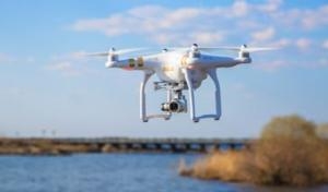
The GEO public beta will work with both DJI’s Phantom 3 and Inspire 1 drones, with specific versions available for download.

(Image provided with DJI news release)

FMI: www.dji.com/flysafe/geo-system

Advertisement

More News

ANN's Daily Aero-Linx (05.06.25)

Aero Linx: International Federation of Airworthiness (IFA) We aim to be the most internationally respected independent authority on the subject of Airworthiness. IFA uniquely combi>[...]

ANN's Daily Aero-Term (05.06.25): Ultrahigh Frequency (UHF)

Ultrahigh Frequency (UHF) The frequency band between 300 and 3,000 MHz. The bank of radio frequencies used for military air/ground voice communications. In some instances this may >[...]

ANN FAQ: Q&A 101

A Few Questions AND Answers To Help You Get MORE Out of ANN! 1) I forgot my password. How do I find it? 1) Easy... click here and give us your e-mail address--we'll send it to you >[...]

Classic Aero-TV: Virtual Reality Painting--PPG Leverages Technology for Training

From 2019 (YouTube Edition): Learning To Paint Without Getting Any On Your Hands PPG's Aerospace Coatings Academy is a tool designed to teach everything one needs to know about all>[...]

Airborne 05.02.25: Joby Crewed Milestone, Diamond Club, Canadian Pilot Insurance

Also: Sustainable Aircraft Test Put Aside, More Falcon 9 Ops, Wyoming ANG Rescue, Oreo Cookie Into Orbit Joby Aviation has reason to celebrate, recently completing its first full t>[...]

blog comments powered by Disqus


Advertisement

Advertisement

Podcasts

Advertisement

© 2007 - 2025 Web Development & Design by Pauli Systems, LC