Yet Another Contribution From GA Helps Clear Katrina Quagmire | Aero-News Network
Aero-News Network
RSS icon RSS feed
podcast icon MP3 podcast
Subscribe Aero-News e-mail Newsletter Subscribe

Airborne Unlimited -- Most Recent Daily Episodes

Episode Date

Airborne-Monday

Airborne-Tuesday

Airborne-Wednesday Airborne-Thursday

Airborne-Friday

Airborne On YouTube

Airborne-Unlimited-05.13.24

Airborne-NextGen-05.07.24

Airborne-Unlimited-05.08.24 Airborne-FlightTraining-05.09.24

Airborne-Unlimited-05.10.24

Tue, Sep 06, 2005

Yet Another Contribution From GA Helps Clear Katrina Quagmire

Though you're still unlikely to hear much about the contribution General Aviation is making to the Katrina recovery effort, one Cessna is having an inestimable impact on Hurricane releif after it was used to map much of the devastation left by Hurricane Katrina.

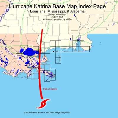
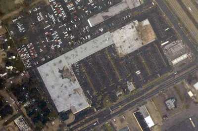
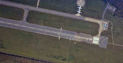
Flown on a rigorous number of high-resolution photo passes at 7500 feet, the photo paths are now being posted online by NOAA so that people can inspect areas of interest, in order to judge the extent of damage and flooding still in the area.

The entire area has yet to be fully photographed, but affected parties have been advised to use these maps in an effort to find their respective neighborhoods and that updates will be posted as soon as they are available.

The maps have been segmented into a multitude of areas with small rectangles signifying the photo paths taken by the Cessna. Users then click on the small black boxes, approximating their area of interest, to zoom to the overhead pictures and/or use the back button in their Internet browser to return to the main map to select other maps and photos.

FMI: http://ngs.woc.noaa.gov/katrina/KATRINA0000.HTM

Advertisement

More News

Sierra Space Repositions Dream Chaser for First Mission

With Testing Soon Complete, Launch Preparations Begin in Earnest Sierra Space's Dream Chaser has been put through the wringer at NASA's Glenn Armstrong Test Facility in Ohio, but w>[...]

ANN's Daily Aero-Term (05.10.24): Takeoff Roll

Takeoff Roll The process whereby an aircraft is aligned with the runway centerline and the aircraft is moving with the intent to take off. For helicopters, this pertains to the act>[...]

Aero-News: Quote of the Day (05.10.24)

“We’re proud of the hard work that went into receiving this validation, and it will be a welcome relief to our customers in the European Union. We couldn’t be mor>[...]

Aero-News: Quote of the Day (05.11.24)

"Aircraft Spruce is pleased to announce the acquisition of the parts distribution operations of Wag-Aero. Wag-Aero was founded in the 1960’s by Dick and Bobbie Wagner in the >[...]

ANN's Daily Aero-Term (05.11.24): IDENT Feature

IDENT Feature The special feature in the Air Traffic Control Radar Beacon System (ATCRBS) equipment. It is used to immediately distinguish one displayed beacon target from other be>[...]

blog comments powered by Disqus


Advertisement

Advertisement

Podcasts

Advertisement

© 2007 - 2024 Web Development & Design by Pauli Systems, LC